Welcome to Flight Sim Travel Guide, a new series from FSNews where our team highlights scenic flights through areas that they share a personal connection to. What better way to begin this new series than with a flight to North Carolina’s Outer Banks! Home to beautiful beaches and wild horses, mysterious disappearances, legendary pirates, historic lighthouses, and the site of the Wright Brothers’ famous first flight.
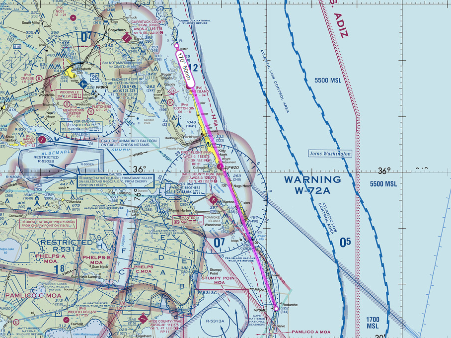
For today’s flight we will be taking a slow scenic VFR trip following the coastline north towards Carova Beach before executing a 180 degree turn and continuing south towards Ocracoke Island. Optionally, we can continue further south to Cape Lookout before turning inland to land on the North Carolina mainland.
We have written this guide to be followed based on headings and ground-based landmarks. If you would prefer to follow GPS, we have also included several .PLN files at the bottom of this article which PC users can import into Microsoft Flight Simulator from the World Map. Xbox users will either need to follow the visual guide as written or use this tutorial to manually enter the flight plan.
Departure Points
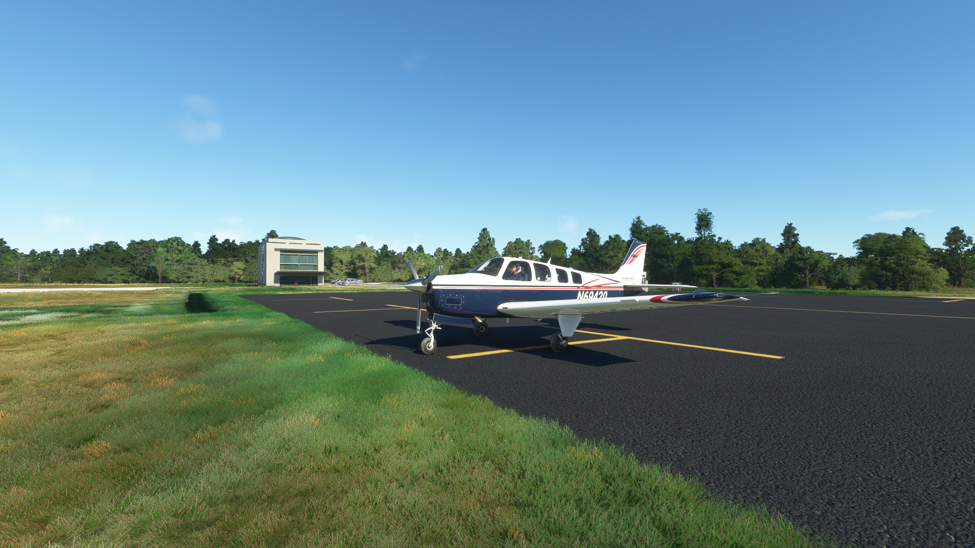
For my departure I have chosen Dare County Regional Airport (KMQI), the nearest public use full service general aviation facility to the Outer Banks (by car that is.) Dare County Airport was originally commissioned in 1943 as Naval Auxiliary Air Station Manteo. Throughout WWII it served as a training base for US Navy fighter and bomber squadrons as well as as base for anti-submarine operations conducted by the US Navy, Coast Guard, and Civil Air Patrol.
If you would prefer, you could instead begin from the nearby First Flight Airport (KFFA) located at the Wright Brothers National Memorial. This airport is operated by the US National Parks Service and lacks fuel services.
If you would like a slightly shorter flight without backtracking, you could depart from Currituck County Regional Airport (KONX), head east until you reach Carova Beach on the Outer Banks, and continue south from there.
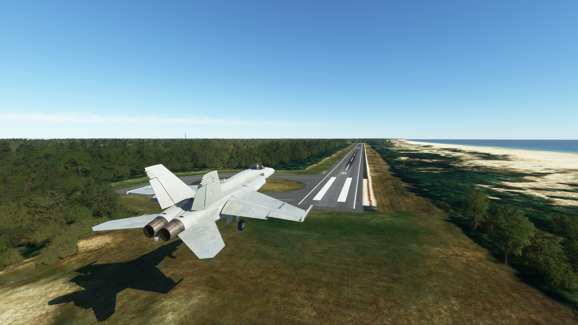
If you want to be “that guy,” then you could depart from Naval Air Station Oceana (KNTU) located north of the Outer Banks in Norfolk Virginia in an F/A-18 Super Hornet and blow through this entire trip at full afterburner in about 20 minutes. You know who you are.
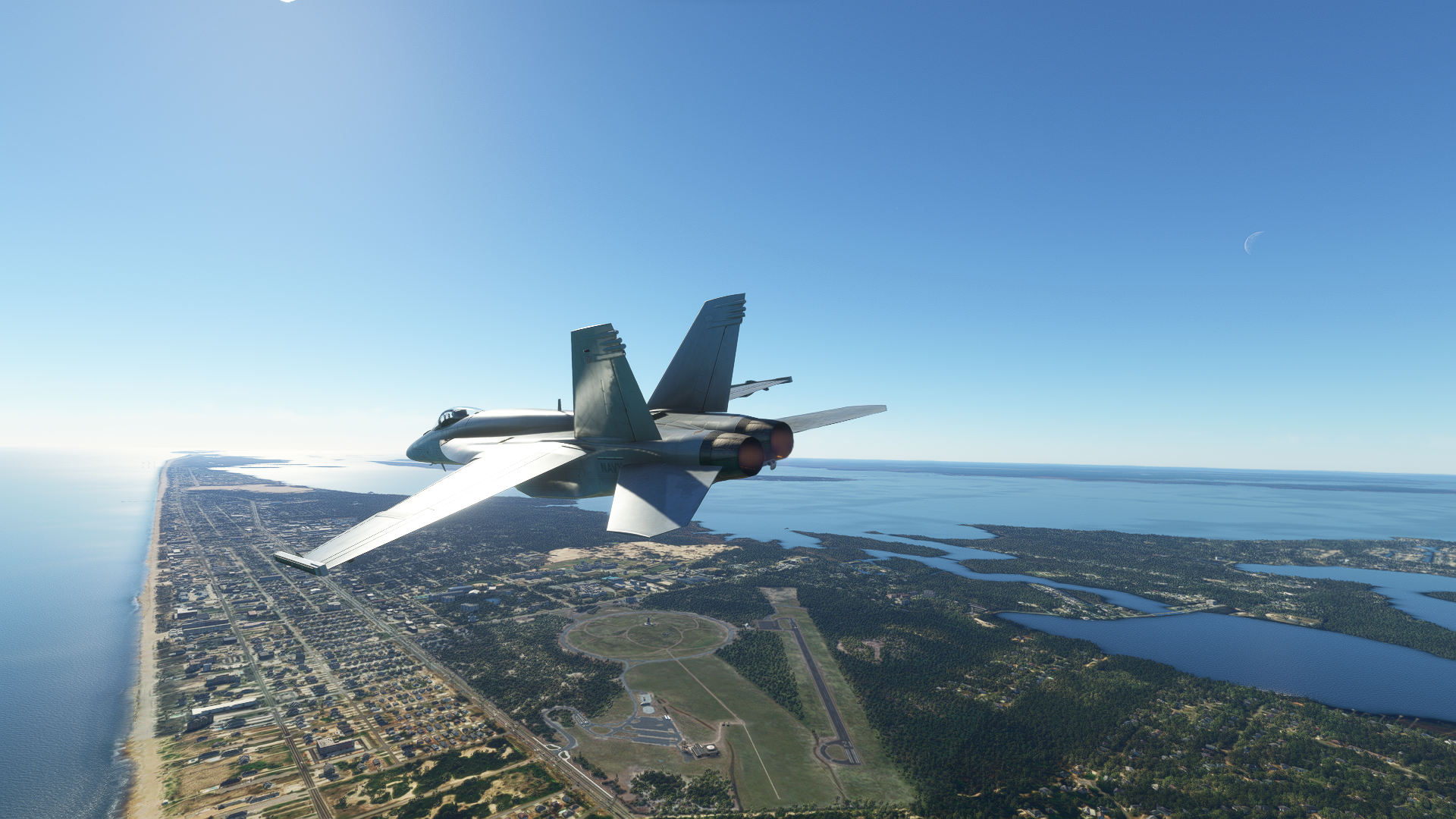
They’re just usually not doing Mach 1.2 at 1500ft.
Recommended Add-Ons
For the best experience, all users should install the optional World Update II: USA which contains enhanced scenery for the Wright Brothers National Memorial and World Update X: USA which includes Cape Hatteras Lighthouse.
Additionally, I recommend PC users install PuffinFlight’s We Love VFR Region 2, Mamudesign’s Power Lines and Solar Farms, Mamudesign’s Marinas, Henrik Nielsen’s Global AI Ship Traffic, and Michaelvp’s Ocracoke Lighthouse.
If you would like a longer flight that continues past Ocracoke to Cape Lookout, I recommend MazerMart’s Cape Lookout Lighthouse and Michael J Smith Field (KMRH).
Total flight time will be between 1.5 to 2 hours dependent on aircraft and route with a total distance between 108-184nm depending on the chosen departure and arrival point. There are no available fuel stops en route, so plan on refueling at Dare County (KMQI), Currituck County (KONX), or Smith (KMRH).
Departure and The Lost Colony of Roanoke
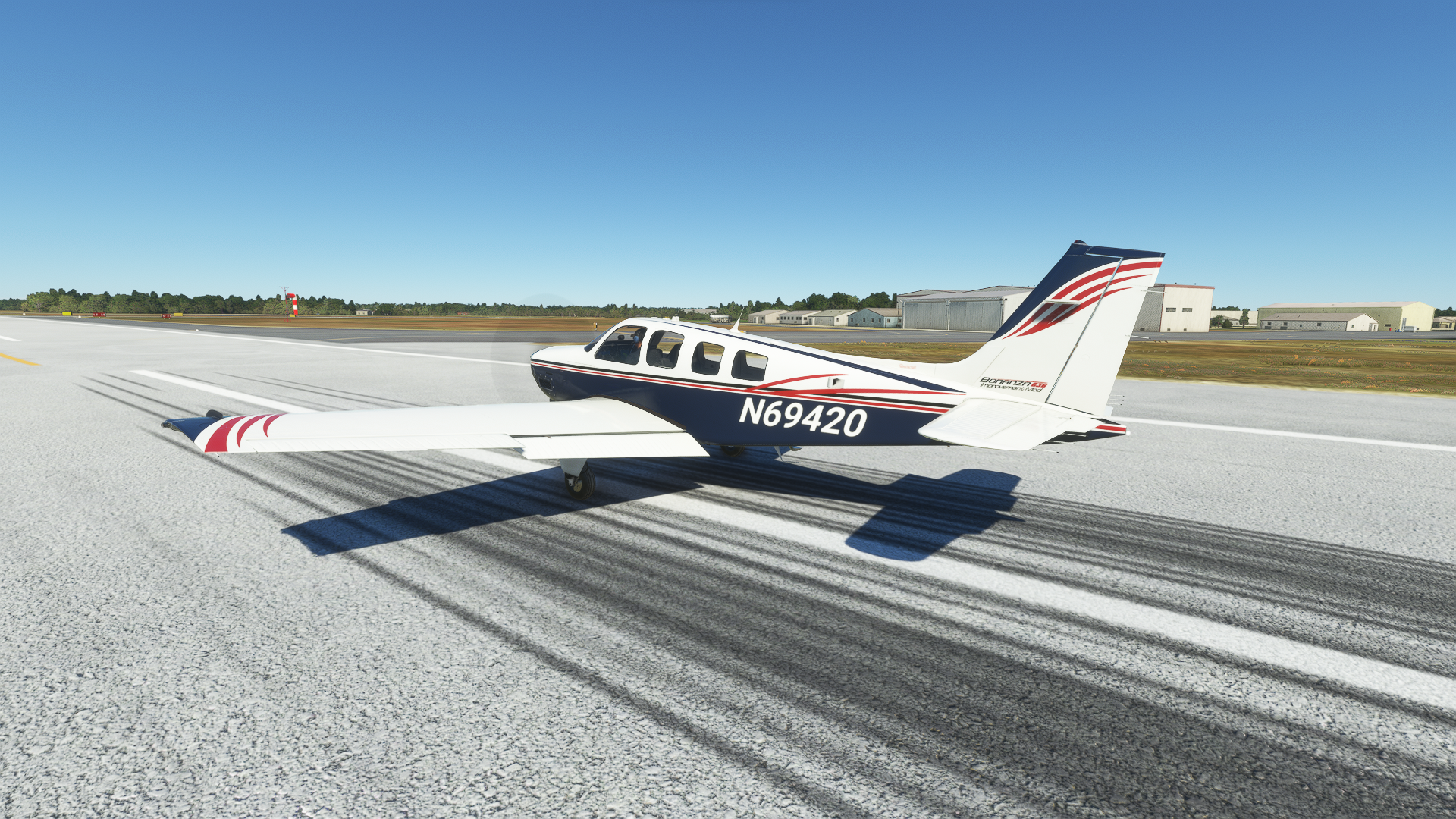
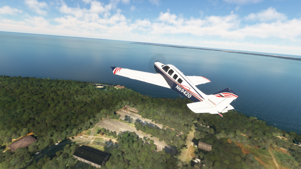
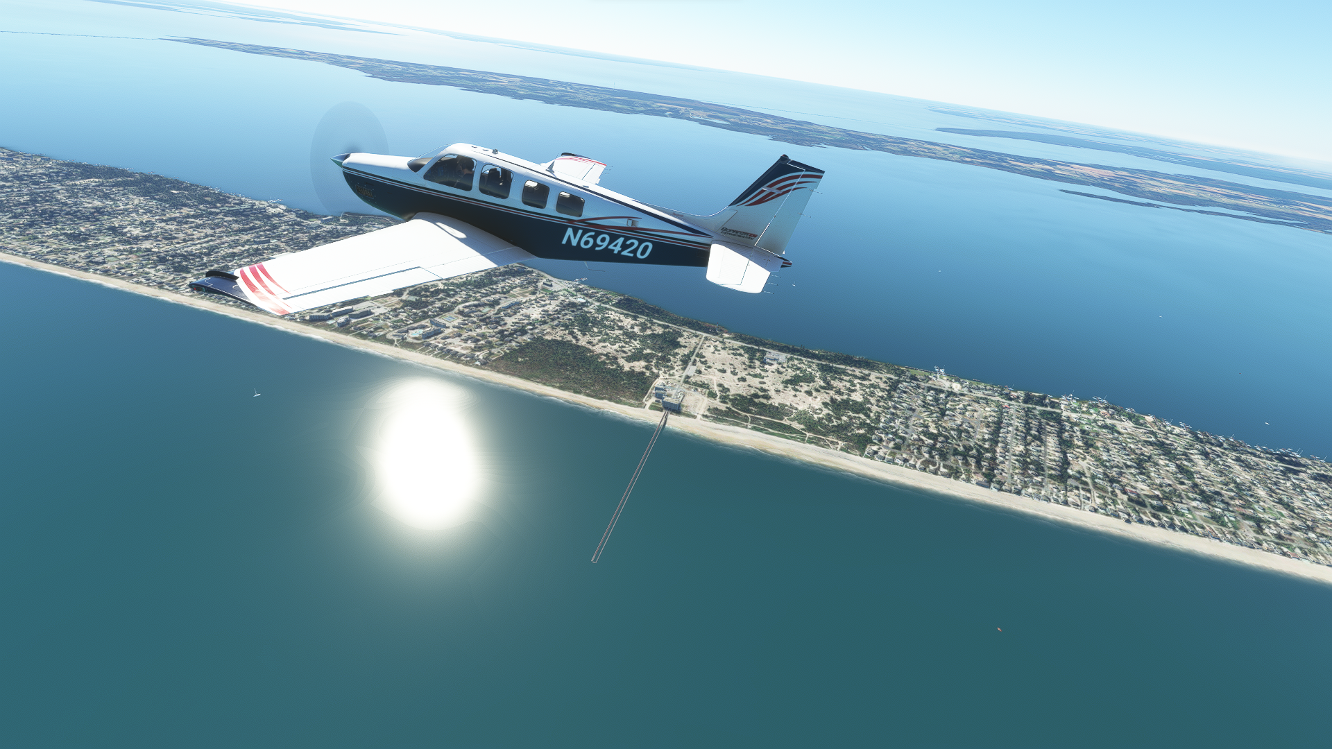
Our flight begins with a departure to the east from Runway 35. I will be flying the default Beechcraft Bonanza with Captmatto’s G36 Improvement Project, but just about any low and slow GA plane will do just fine.
Dare County Regional Airport is situated in Manteo, North Carolina, on Roanoke Island. For those of you who paid attention in US History, yes THAT Roanoke.
As we depart Dare County Airport, we will pass over Fort Raleigh National Historic Site. The site marks the location of the Roanoke Colony, the first permanent English settlement in The New World, established in 1585. In 1590, a resupply mission returning from Europe found that the colonists had disappeared without a trace. The word ‘CROATOAN’ was found carved into the wall of the settlement leading to speculation that the colonists had relocated inland to live among the native Croatoan tribe. To date, no conclusive archeological evidence on the fate of the colonists has been found.
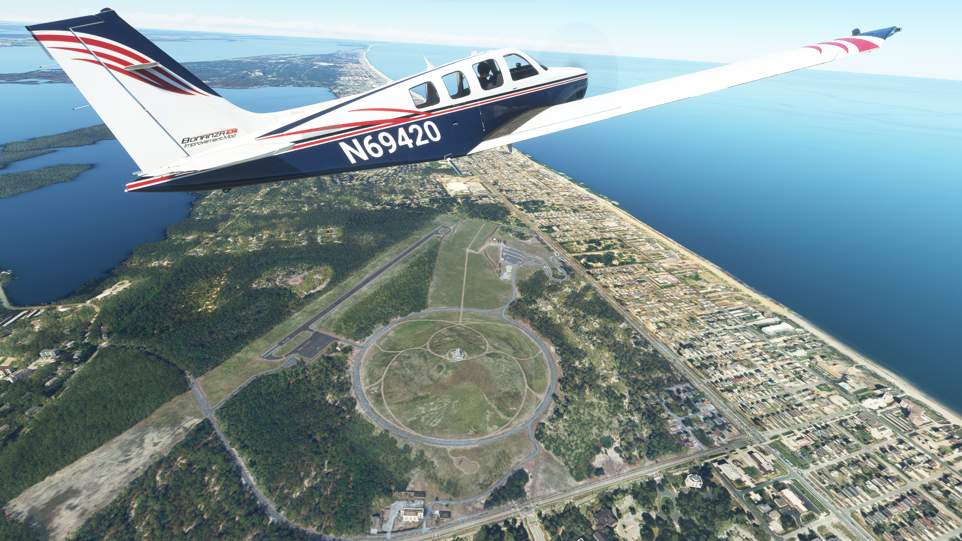
The Wright Brothers National Memorial and First Flight Airport
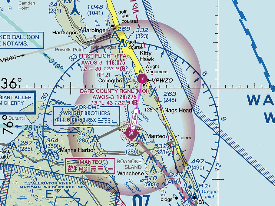
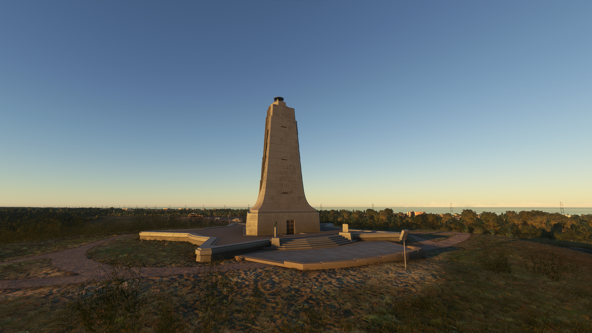
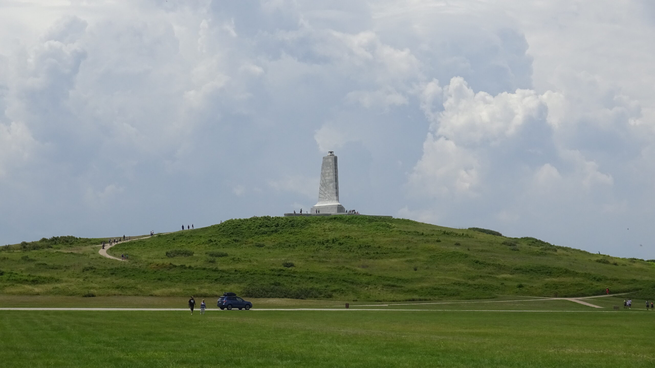
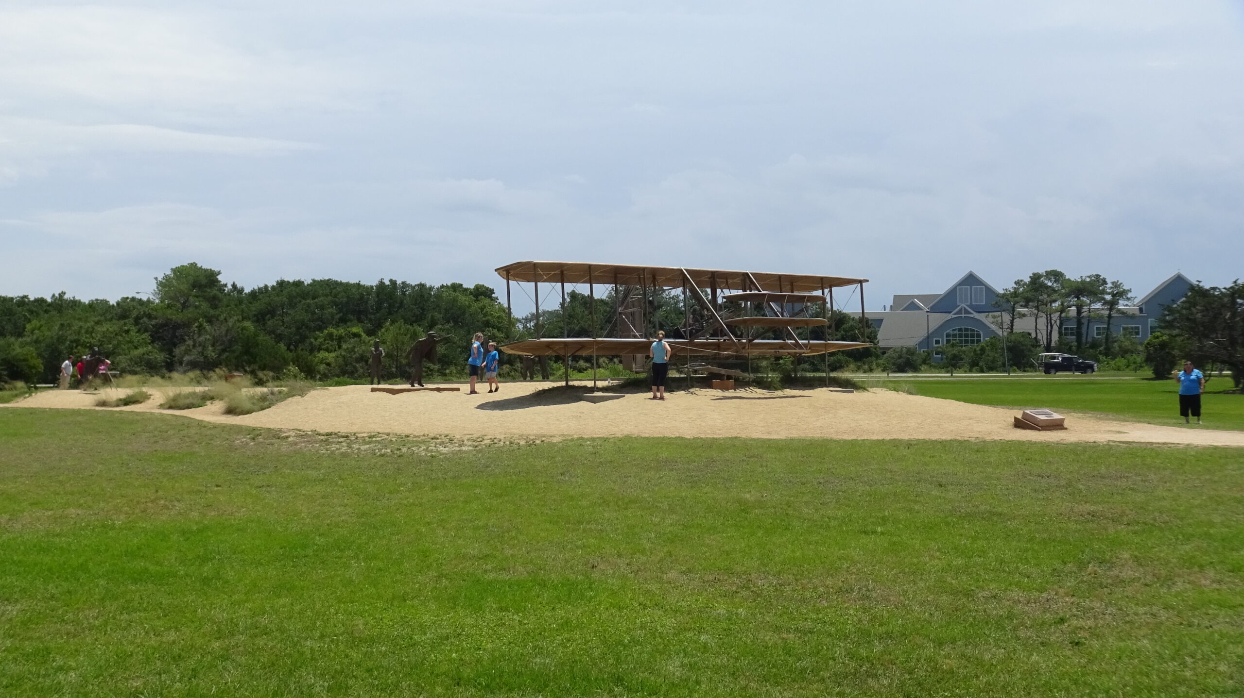
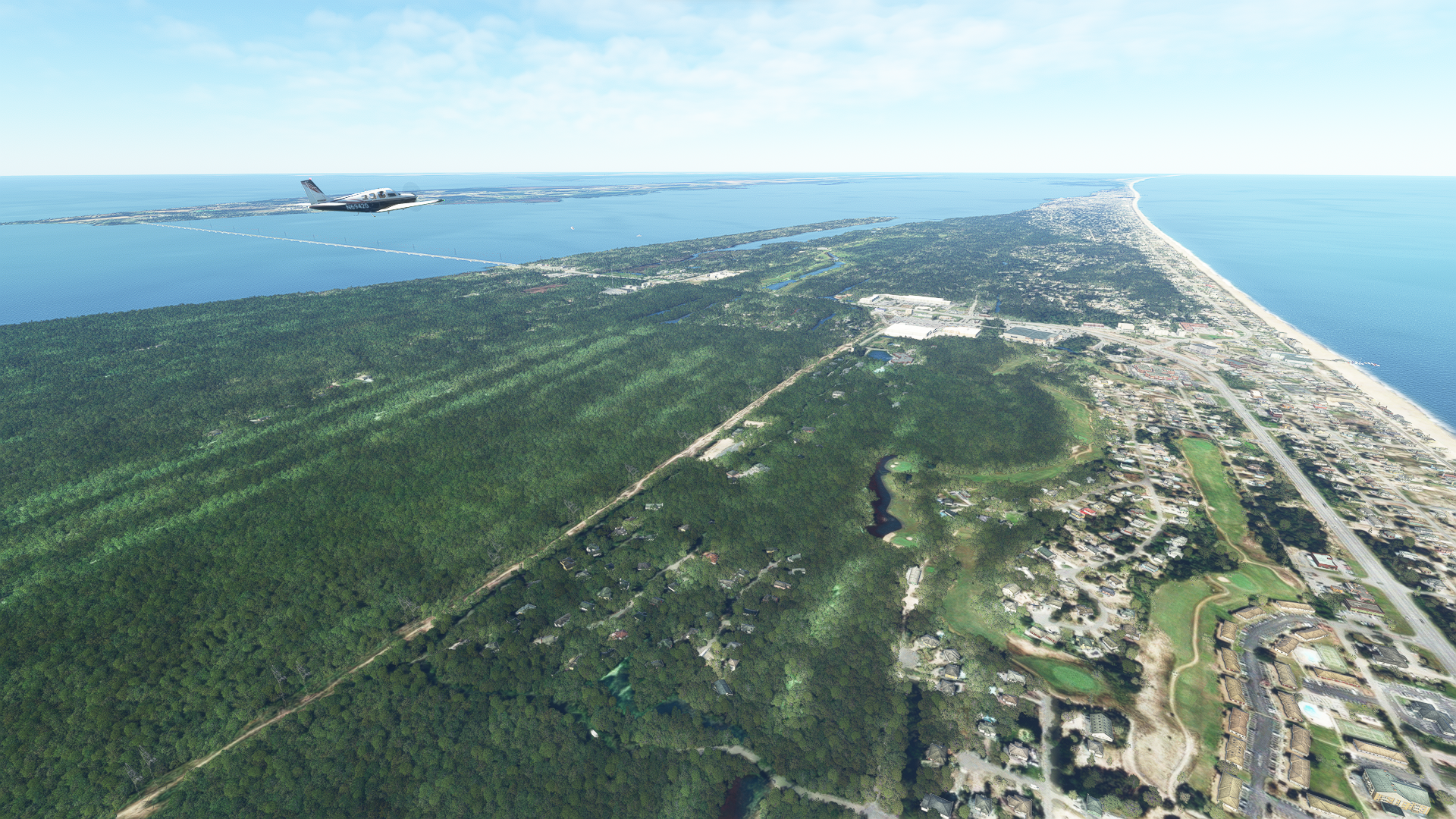
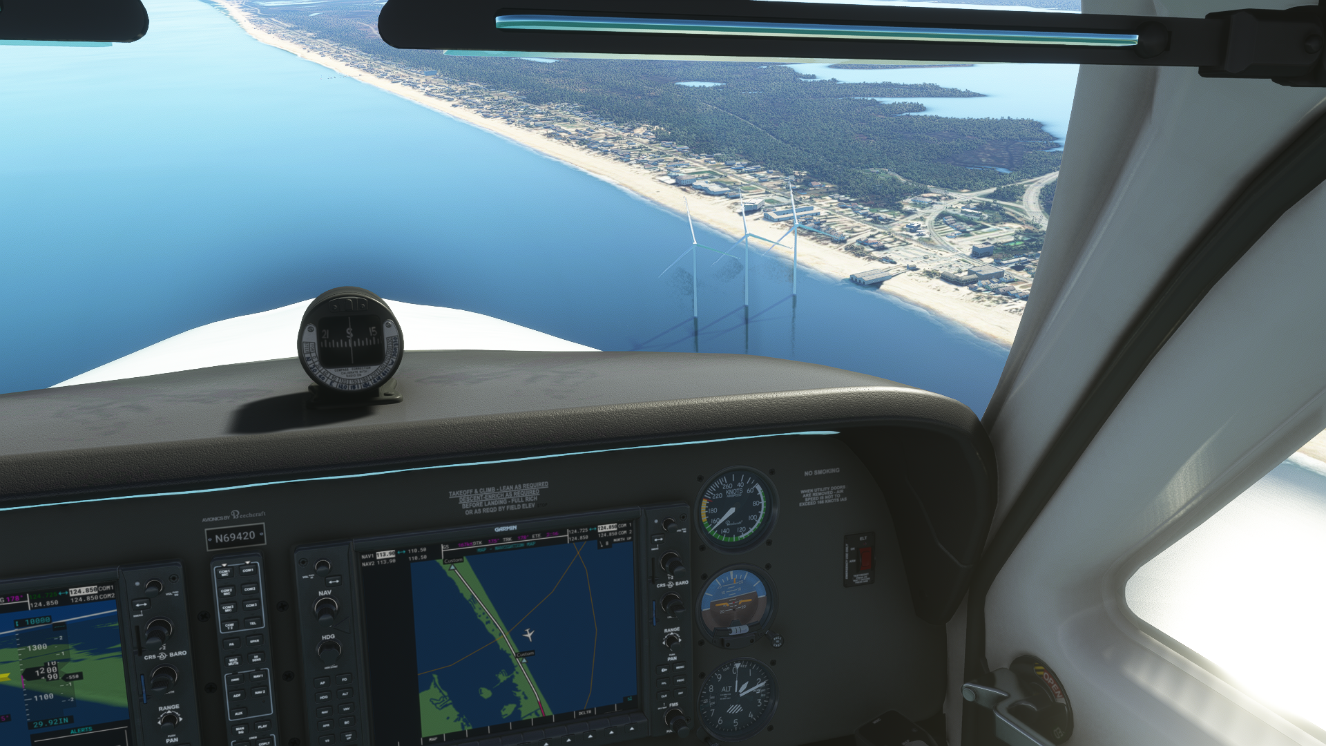
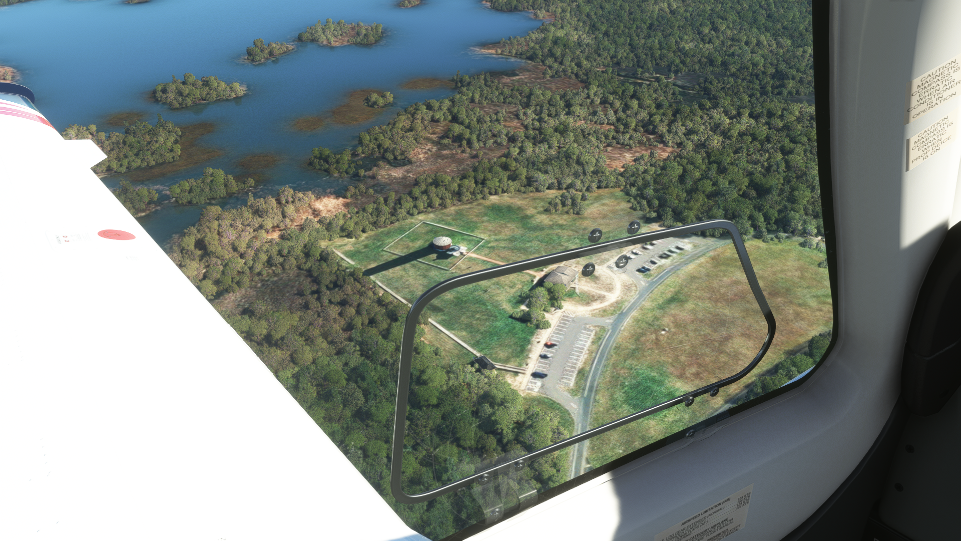
As we leave the island, turn right heading 022° and fly over the Currituck Sound for 6nm towards Bodie Island, technically pronounced “body island,” but even some native North Carolinians call it “bode-ie.” Since the inlet closed in 1811, Bodie Island is technically a peninsula and part of the mainland. As we approach the island, look for a large grassy area and a stone obelisk. It is here we will encounter our first POI, The Wright Brothers National Memorial.
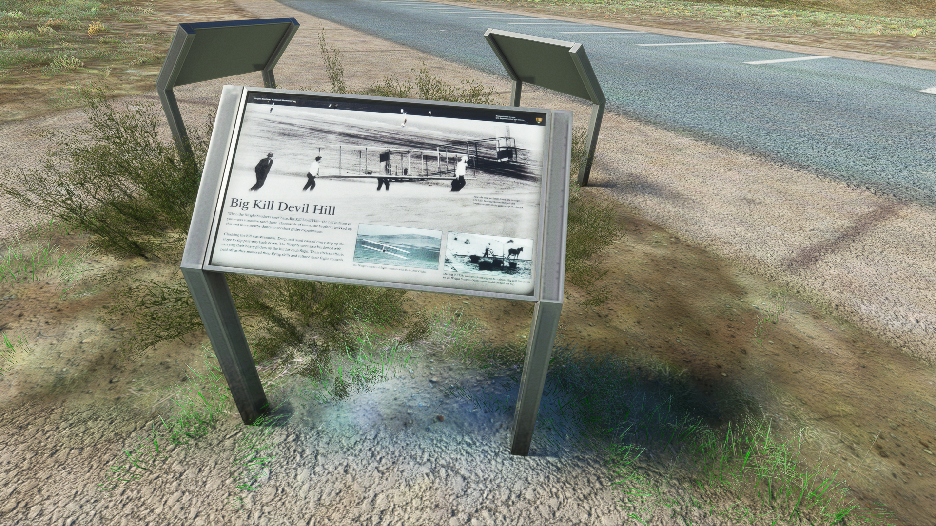
In 1903, the sand dunes of Kitty Hawk North Carolina served as the site of the Wright Brothers famous first flight, though calling the event “the first flight” may be a bit reductive. More accurately, the Wright Brothers were responsible for the first manned, powered, controlled, sustained, and most importantly documented flight of a heavier-than-air aircraft. The area was chosen by the Ohio-born brothers due to its predictable and sustained winds and remote location.
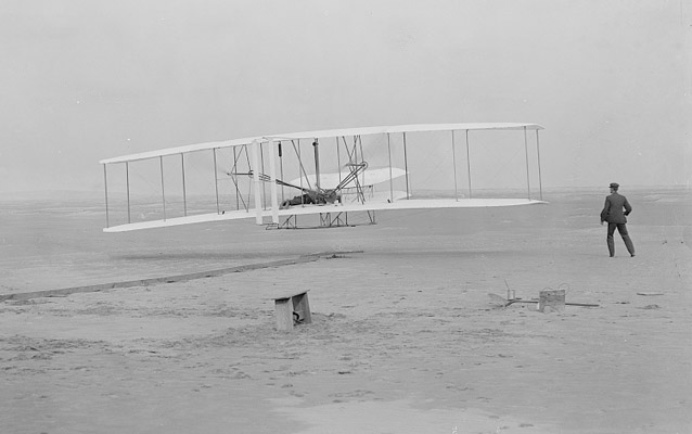
The memorial was established in 1927 and is maintained and managed by the United States National Parks Service. A small general aviation airport built in 1928, First Flight Airport (KFFA), is located along the northeastern edge of the park.
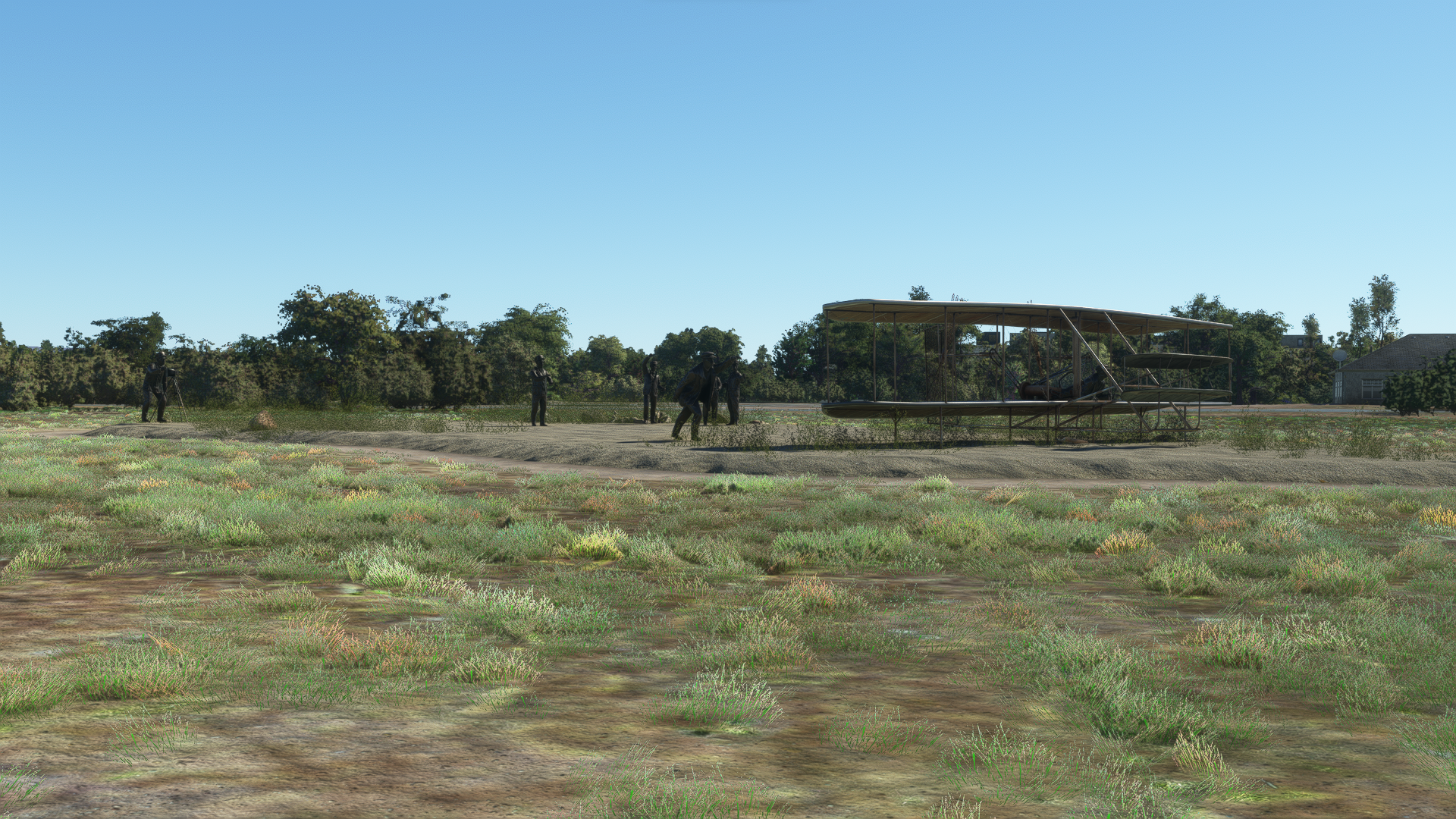
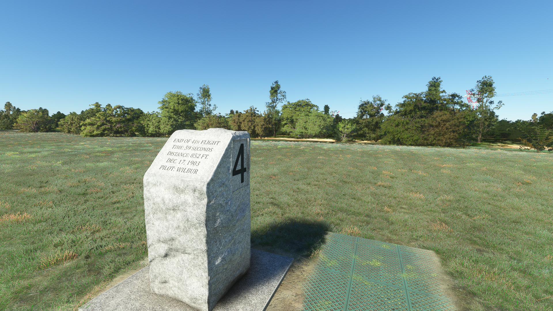
If you choose to take off from First Flight Airport, you will pass the stone markers that record the distances of the Wright Brothers’ first 4 flights. As you take to the sky, take a moment to reflect on how far we’ve come in just over 100 years… or just flex on Wilbur Wright by flying circles around his stone.
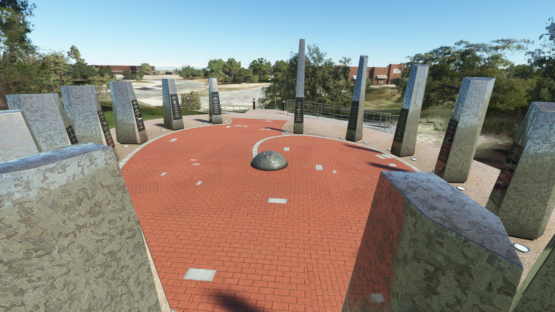
Wright Memorial Bridge and The Century of Flight Monument
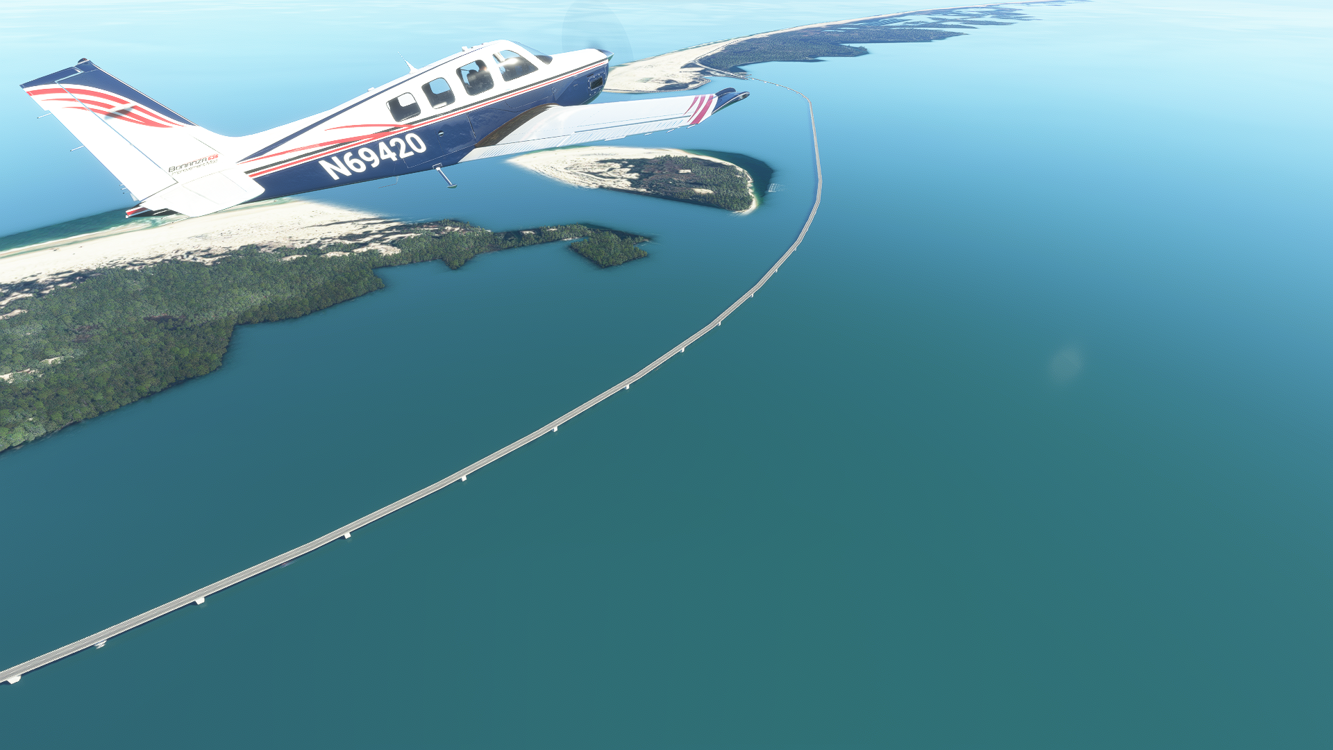
As we pass the Wright Brothers National Memorial turn left heading 351° and maintain this heading for 23nm. You should be able to spot North Carolina Highway 12, the main highway which runs the length of the Outer Banks connecting most communities on the islands. Follow the highway until you see a large T junction. To the east, you should see Wright Memorial Bridge, one of three bridges connecting the Outer Banks to the US Mainland.
Nestled between the shopping centers and big box stores, you may be able to spot a series of stainless steel pylons near a red brick pathway. This is the Century of Flight Monument, a memorial dedicated in 2003 to humanity’s various aerospace achievements.
Pine Island Airport, Currituck Lighthouse, and Carova Beach
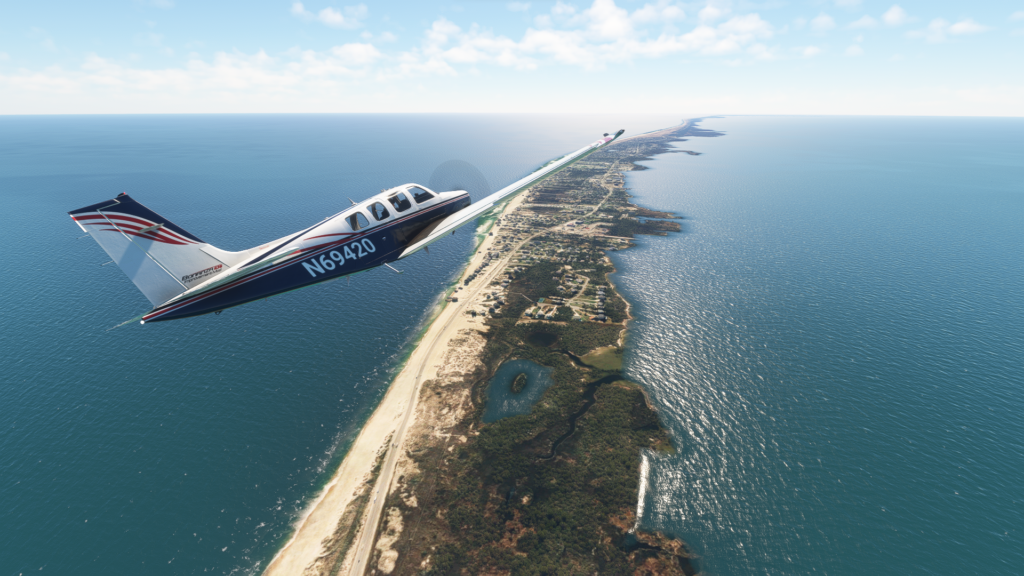
Continue following NC-12 to the north as it passes through the towns of Southern Shores and Duck. Much of the Outer Banks, especially the sections closest to the bridges, serves largely as a seasonal vacation destination. Many resort hotels and rental properties are available to accommodate almost any size gathering.
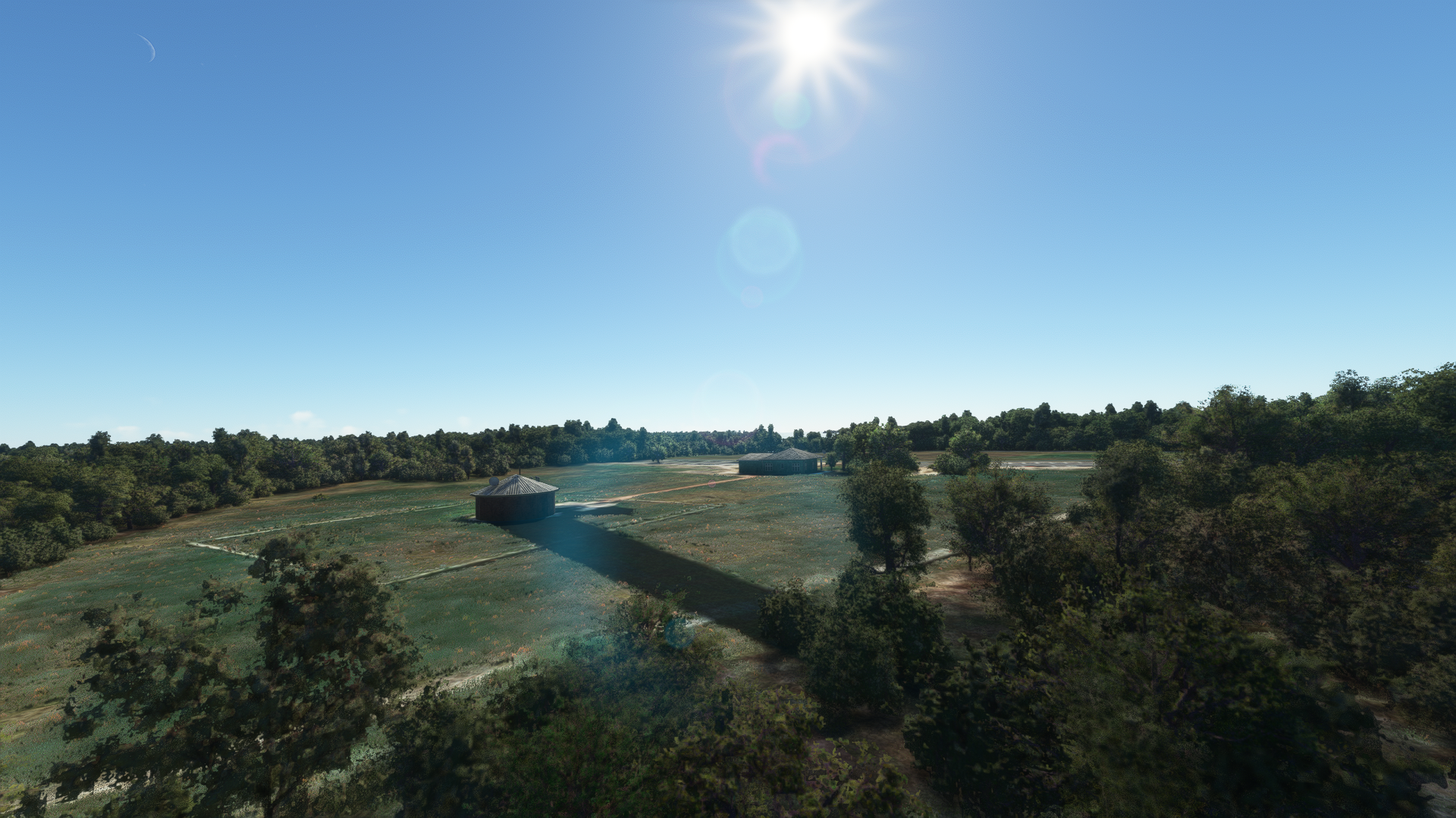
After 10 miles, you will be able to spot Pine Island Airport (7NC2), a privately owned airstrip serving the owners and renters of properties managed by Atlantic Realty.
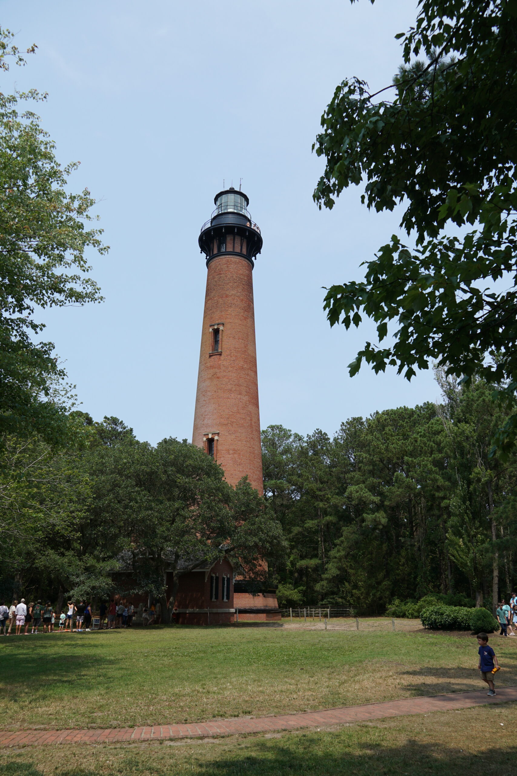
Continue following NC-12 to the north for another 8 miles. In the real world, you’d be able to spot Currituck Beach Lighthouse, a beautiful 162 ft tall red brick lighthouse built in 1875. Unfortunately, this lighthouse is not represented in the sim. If you have installed PuffinFlight’s We Love VFR Region 2 you’ll be able to spot an autogen radio tower where the lighthouse should be as a consolation prize.
About 1 mile to the northeast, you’ll notice that NC-12 abruptly ends in a heavily rutted section of beach. North of this point lies Carova Beach, a series of communities accessible only via 4-wheel drive vehicle or by boat. Officially, the beach is still part of NC-12, with the highway continuing along the beach before ending at the Virginia border. Parking permits are available for those who wish to drive onto the beach and use their vehicle as a basecamp for a day of fishing or swimming.
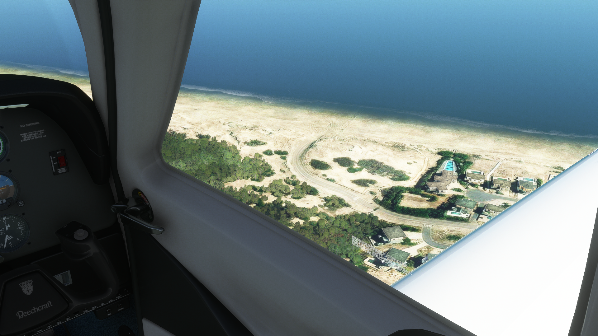
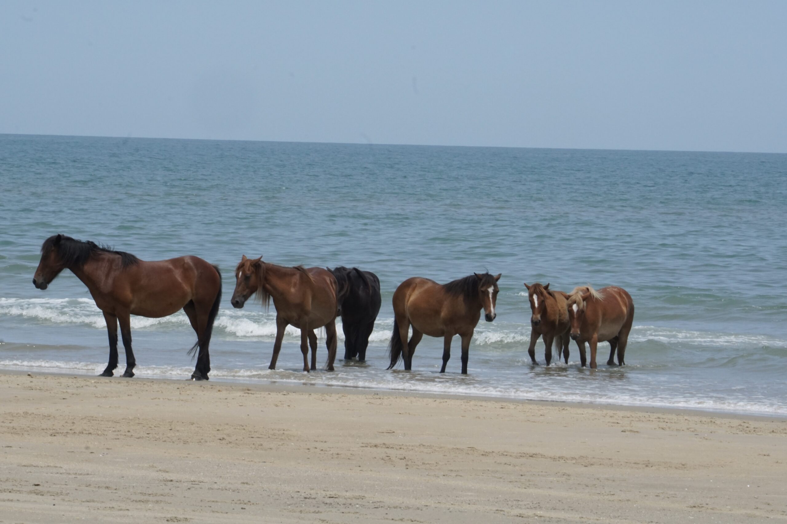
At this point, we can continue following the beach and try to spot some of the Outer Bank’s famous wild horses, widely believed to be descendants of horses that came ashore from the wreck of a Spanish Galleon in the 1500s. Of course, this is flight sim so there are no horses. Sorry to disappoint you. At your discretion execute a 180 degree turn and follow the beach heading south. Fly a heading of 170° for 13nm.
US Army Corps of Engineers Coastal Hydraulics Laboratory Field Research Facility
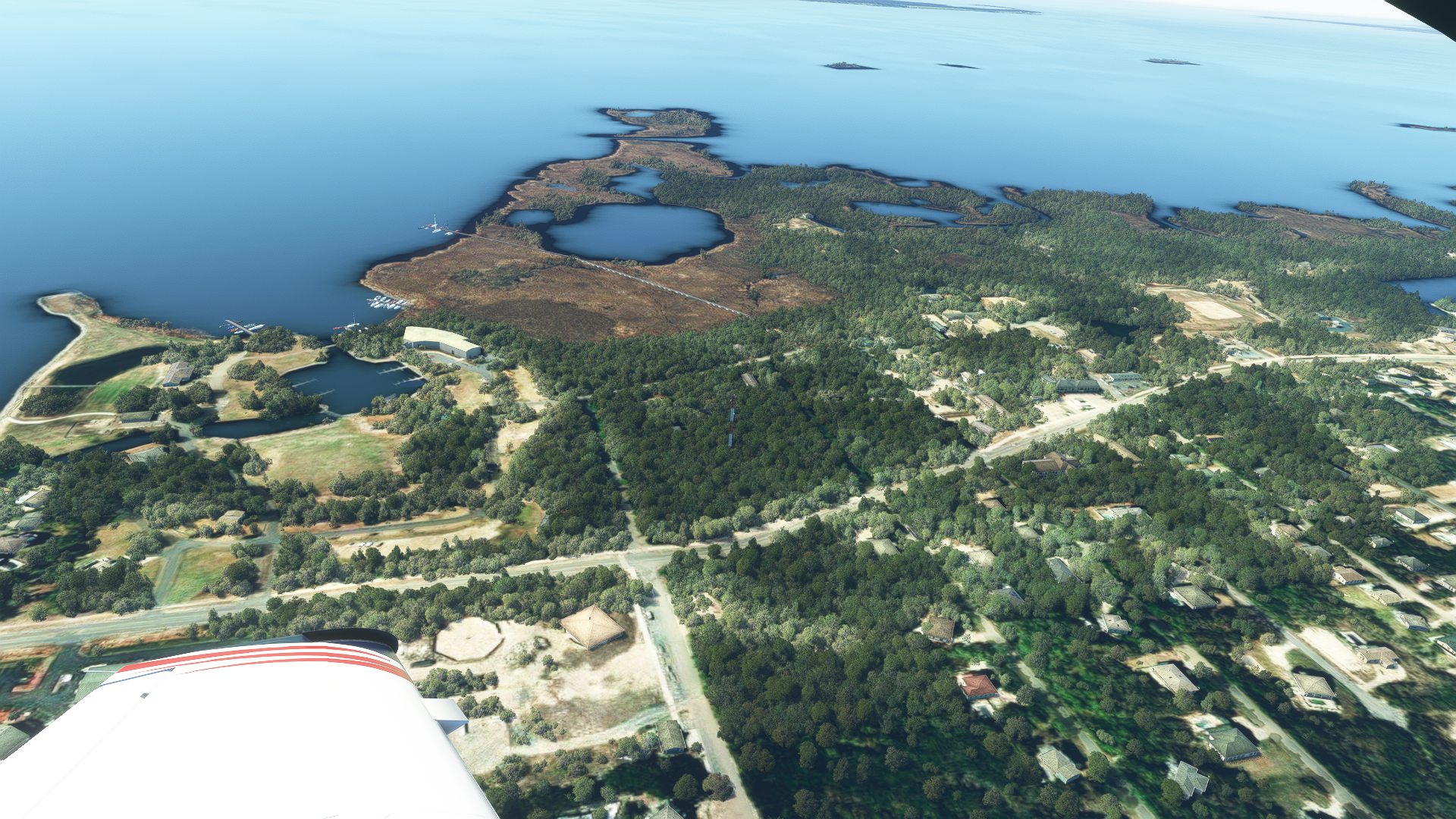
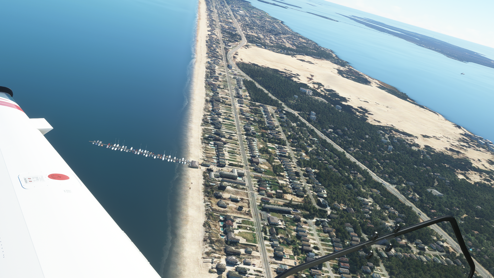
Approximately 13 miles to the south of the Carova Beach access, if you’ve installed Mamudesign’s Marinas you should be able to spot a 560m long pier jutting out into the Atlantic Ocean as you pass back through the town of Duck. This is the US Army Corps of Engineers Coastal Hydraulics Laboratory Field Research Facility. Established in 1977, the facility measures ocean currents and near-shore conditions for the purpose of studying storms and beach erosion.
Jockey’s Ridge and Fishing Piers
After passing the USACECHLFRF, continue following heading 170° along the beach for 14nm. We will be passing the Wright Memorial Bridge and the Wright Brothers National Memorial once again. If you have installed Mamudesign’s Marinas you should be able to spot Nags Head Pier, a fishing pier that extends over the beach and into the ocean.
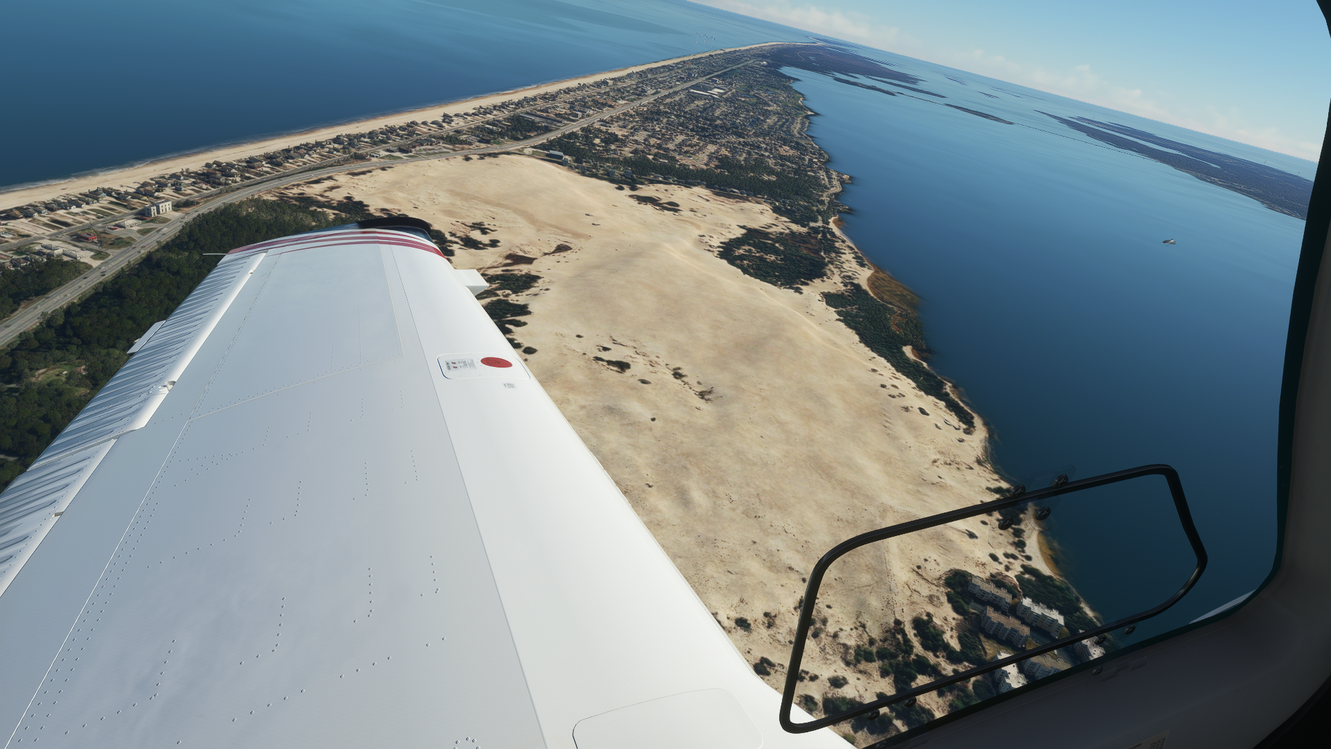
Just to the southwest of the pier, you’ll see a large sandy area on the sound side of the island. This is Jockey’s Ridge State Park. Home to the largest sand dunes on the east coast, the park gives visitors an idea of what Kitty Hawk looked like during the Wright Brothers first flight. Today, the same high dunes and consistent winds that drew the Wrights to North Carolina make the park a popular spot for kite flying and hang gliding.
Maintain a heading of 170°. 4nm to the south lies another fishing pier, Jennette’s Pier, confusingly rended by my autogen add-ons as a series of offshore wind turbines. The Washington Baum Bridge which connects Bodie Island to our starting point of Roanoke Island can be seen on the sound side of the island opposite the “pier.”
Cape Hatteras National Seashore and Bodie Island Lighthouse
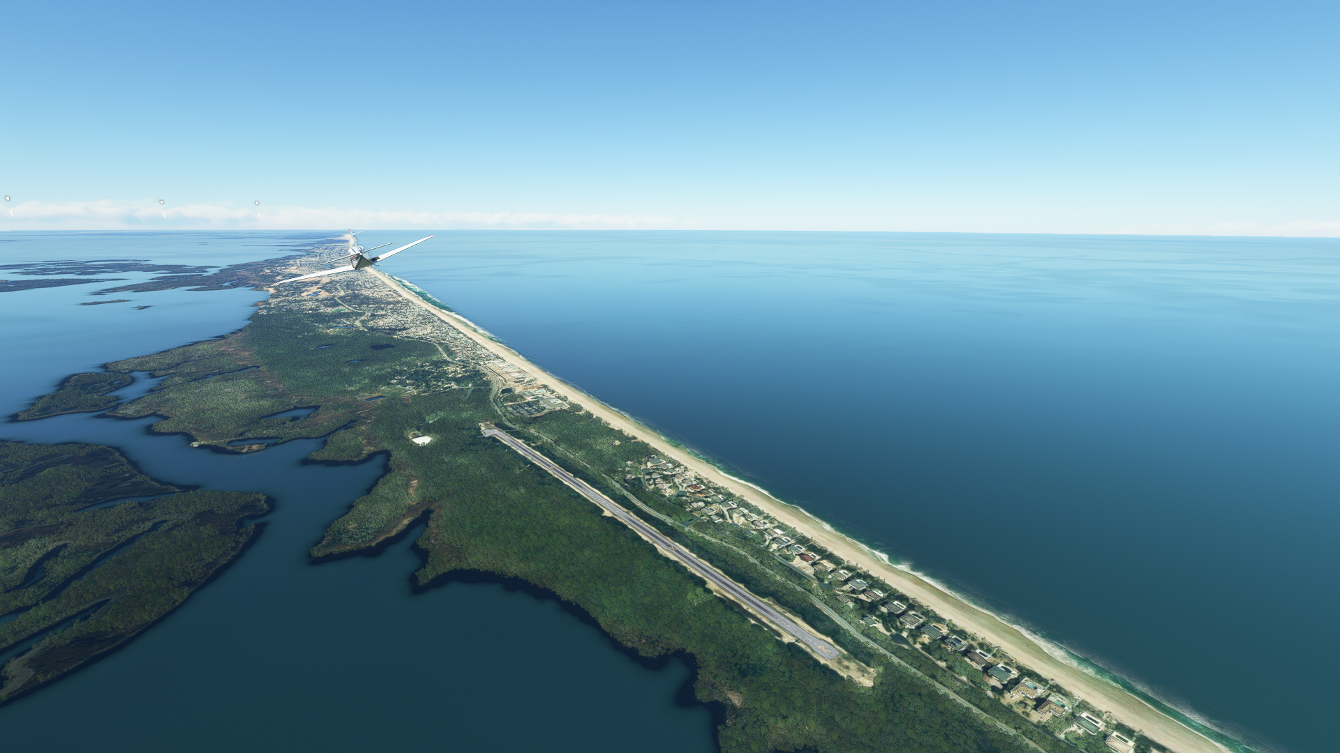
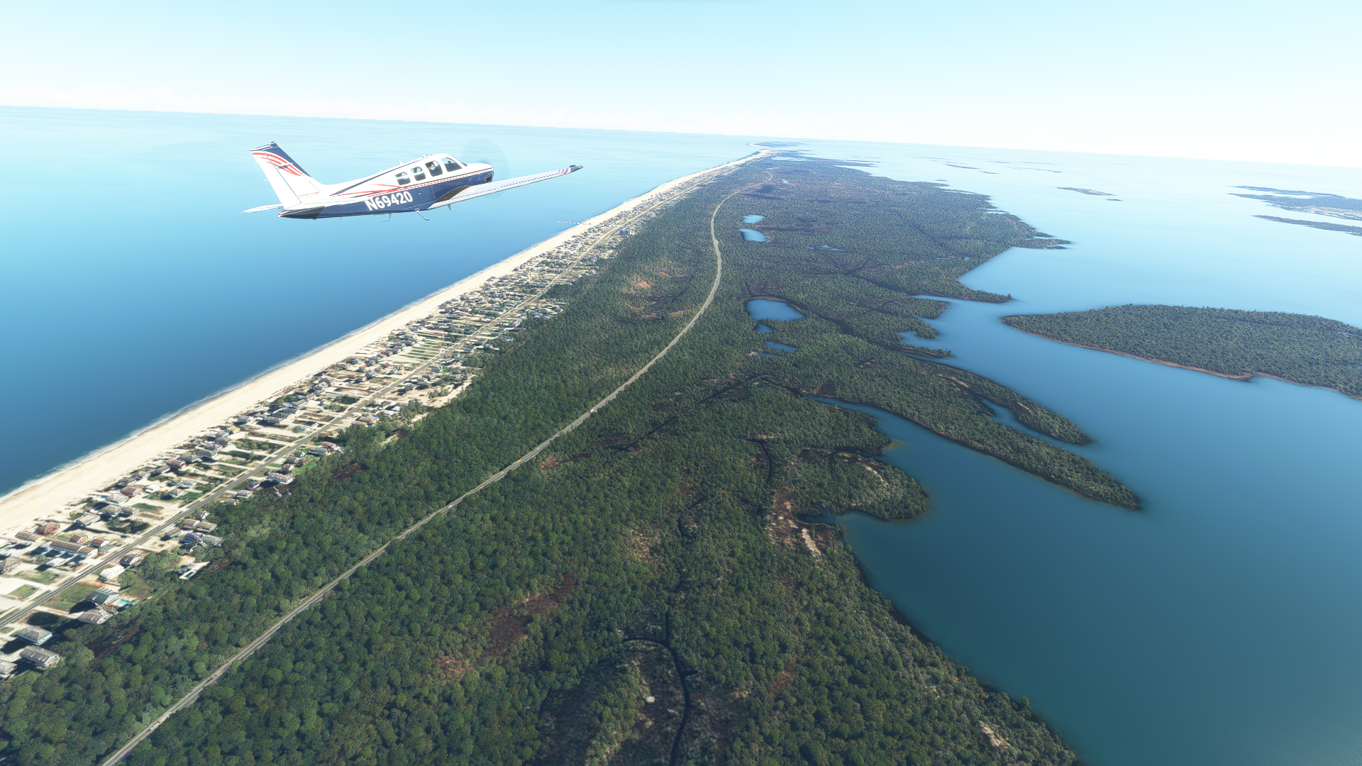
Continue following the shoreline south, and you’ll eventually notice the houses and shopping centers give way to trees and marshlands. Welcome to Cape Hatteras National Seashore, a 70-mile stretch of protected coastline managed by the US National Parks Service.
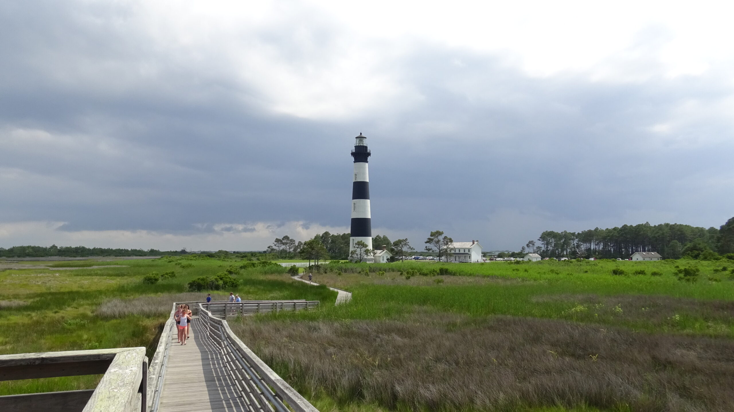
About 6nm after crossing Baum Bridge, in the real world you would be able to spot Bodie Island Lighthouse, my personal favorite Outer Banks lighthouse. Built in 1871 and standing at 156 ft, Bodie Island Lighthouse was actually the third lighthouse to be built on the site. Unfortunately, Bodie Island lighthouse is not represented in the sim and instead is replaced by generic autogen.
Basnight Bridge and Rodanthe, NC
3nm beyond Bodie Island Lighthouse, we’ll encounter Oregon Inlet and Marc Basnight Bridge. Opened in 2019, Basnight Bridge replaced Bonner Bridge which carried NC-12 over the inlet since 1963. A 1000ft section of the original bridge was retained for use as a fishing pier and a jetty to control erosion. Beyond the bridge lies Pea Island National Wildlife Refuge and Hatteras Island.
After the bridge, continue following a heading of 170° for 12nm until you reach the town of Rodanthe, NC (pronounced “Rodanthy.”) Just before the town, you should be able to spot the Eye of Rodanthe, a small inland island surrounded by clear blue waters, made famous by the 2002 Nicholas Sparks Novel Nights in Rodanthe and it’s 2008 film adaptation. In the real world, you would be able to spot Jug Handle Bridge off the right side of the island which opened to traffic in 2022 and now carries NC-12 away from the path of encroaching tides. In sim, the bridge is still under construction and no opening date has been posted.
The Graveyard of the Atlantic
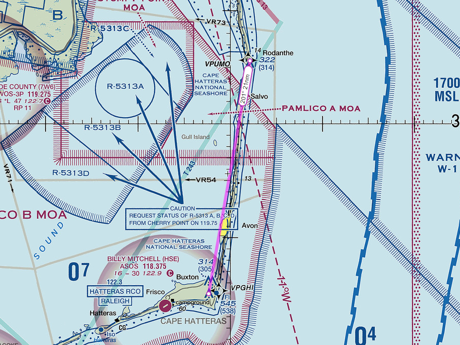
Turn right heading 201° to follow the shoreline south towards Cape Hatteras which is about 21nm away. We’ll be passing through several military operations areas controlled by Cherry Point MCAS but I’ve been told nobody should be flying military jets in MSFS other than F-18 guy so don’t worry about that to much.
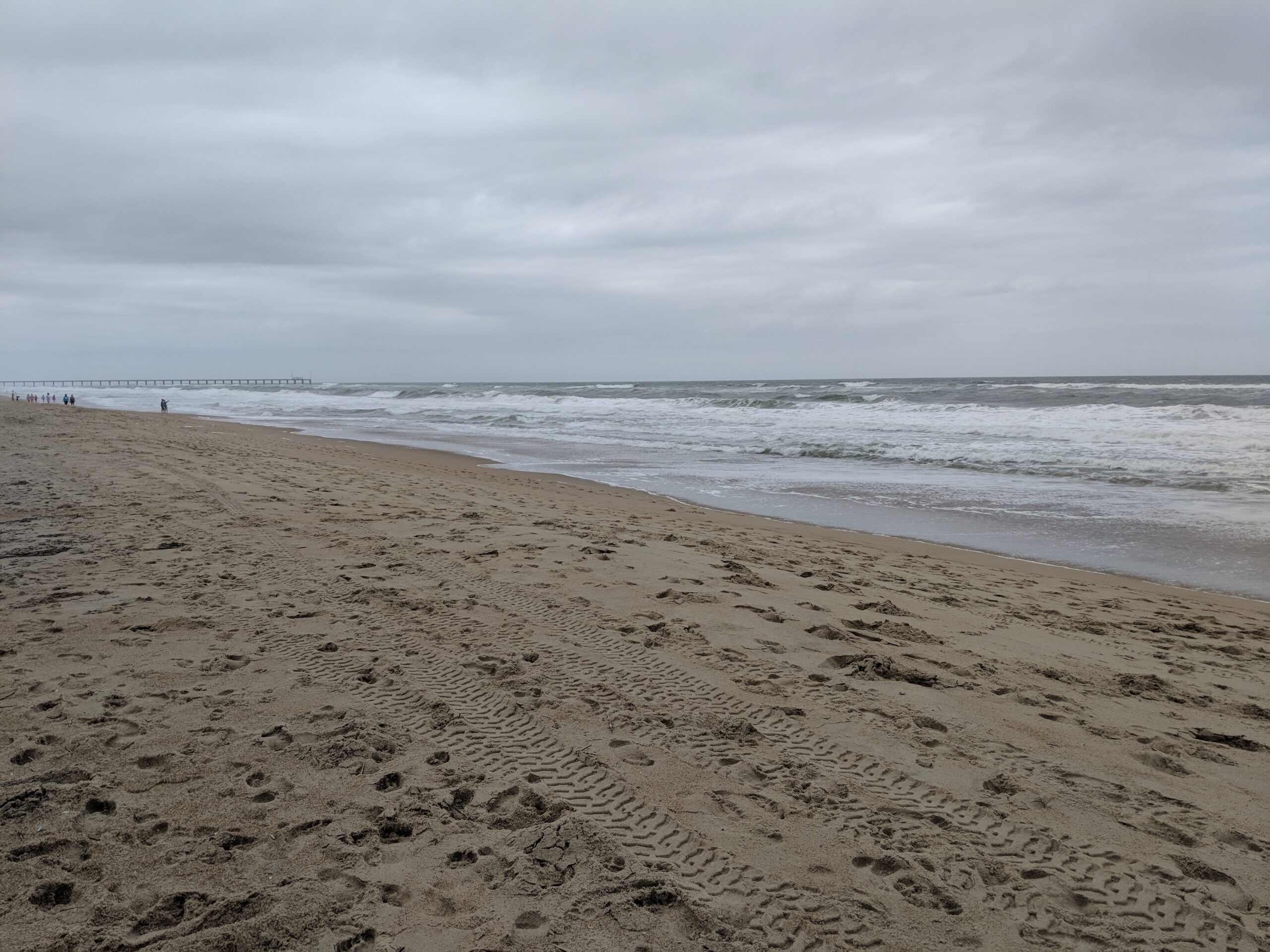
This feels like as good a time as any to talk about that body of water off the left side of the aircraft. That’s the Atlantic Ocean! More specifically, the coastal waters off of the Outer Banks are known as “The Graveyard of the Atlantic.” Since official record keeping began in 1526, more than 5,000 ships have meet a watery grave off the North Carolina coast. Frequent storms and shifting sands made this section of the ocean particularly hazardous to ships. This coupled with the popularity of the area as an anchorage for pirates made traversing the waters of the Outer Banks a dangerous undertaking.
To make matters worse, the Outer Banks was also home to groups of scavengers known as “wreckers” who made their living scavenging the wrecks of ships that had run aground. In some cases, the wreckers were known to lure ships to shore using lanterns hung on horses, the idea being that a passing ship may see the lantern moving up and down and interpret it as another ship. Thinking the area was safe, the ship would run aground on the beach where the wreckers would make quick work of the cargo.
During WWII, the Graveyard of the Atlantic took on another nickname, “torpedo alley.” German U-boats would lurk offshore and prey on unsuspecting merchant ships carrying supplies to Europe. Between 1942 and 1945 nearly 400 ships were sunk by U-Boats off the North Carolina coast killing over 5,000 sailors.
Today, thanks to modern navigation techniques and the relative infrequency of German U-boat attacks, the Graveyard of the Atlantic is considerably less deadly, however shipwrecks do still happen. In 2012, the sailing ship Bounty, a replica of the infamous HMS Bounty, was lost off the coast of Cape Hatteras during Hurricane Sandy, killing two crew members. In 2020, the 72ft fishing vessel Ocean Pursuit ran aground on Bodie Island and sank into the sand. The crew was safely rescued.
A museum dedicated to The Graveyard of the Atlantic and artifacts recovered from various shipwrecks was opened in Hatteras Village in 2002.
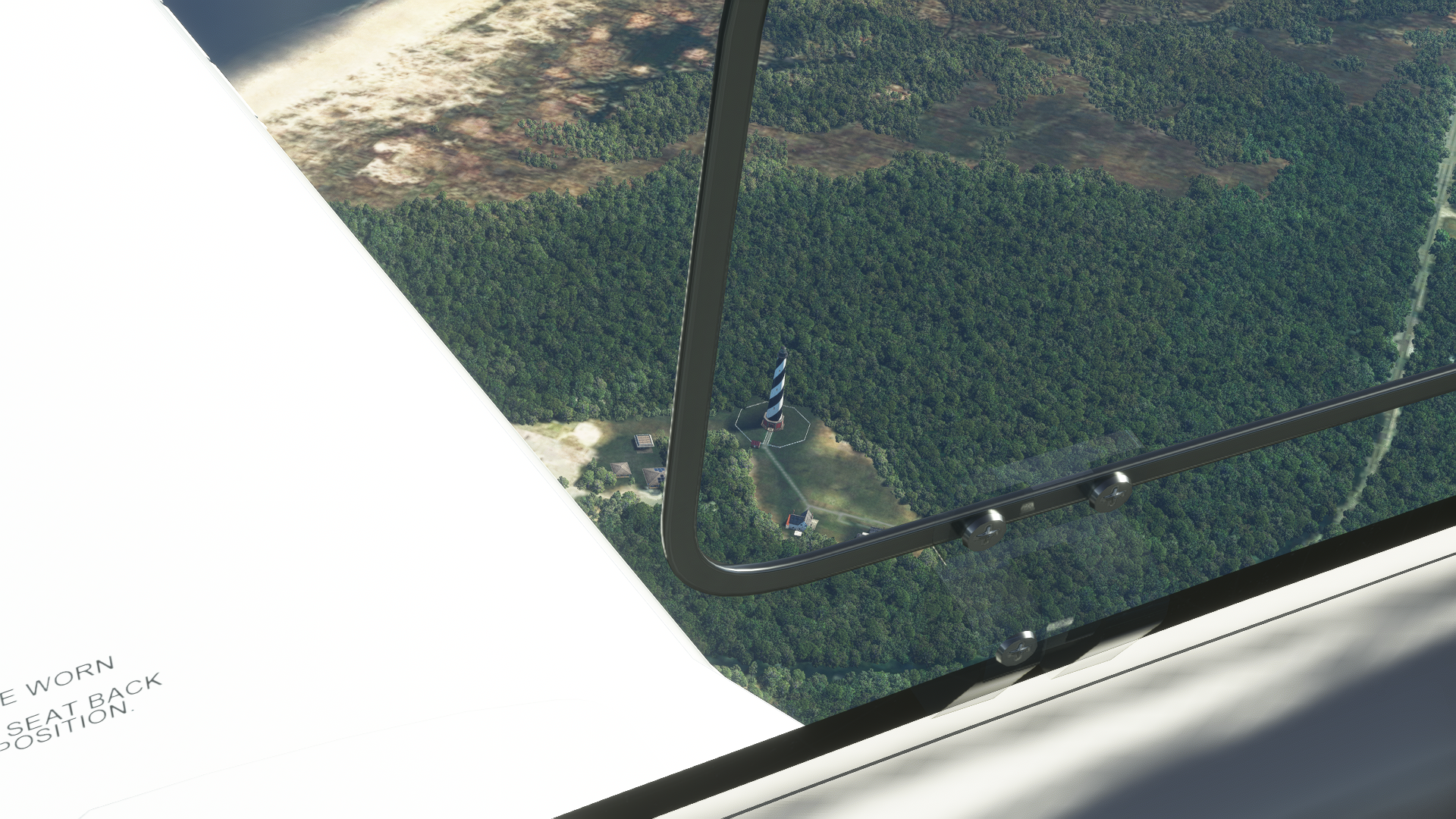
Cape Hatteras Lighthouse
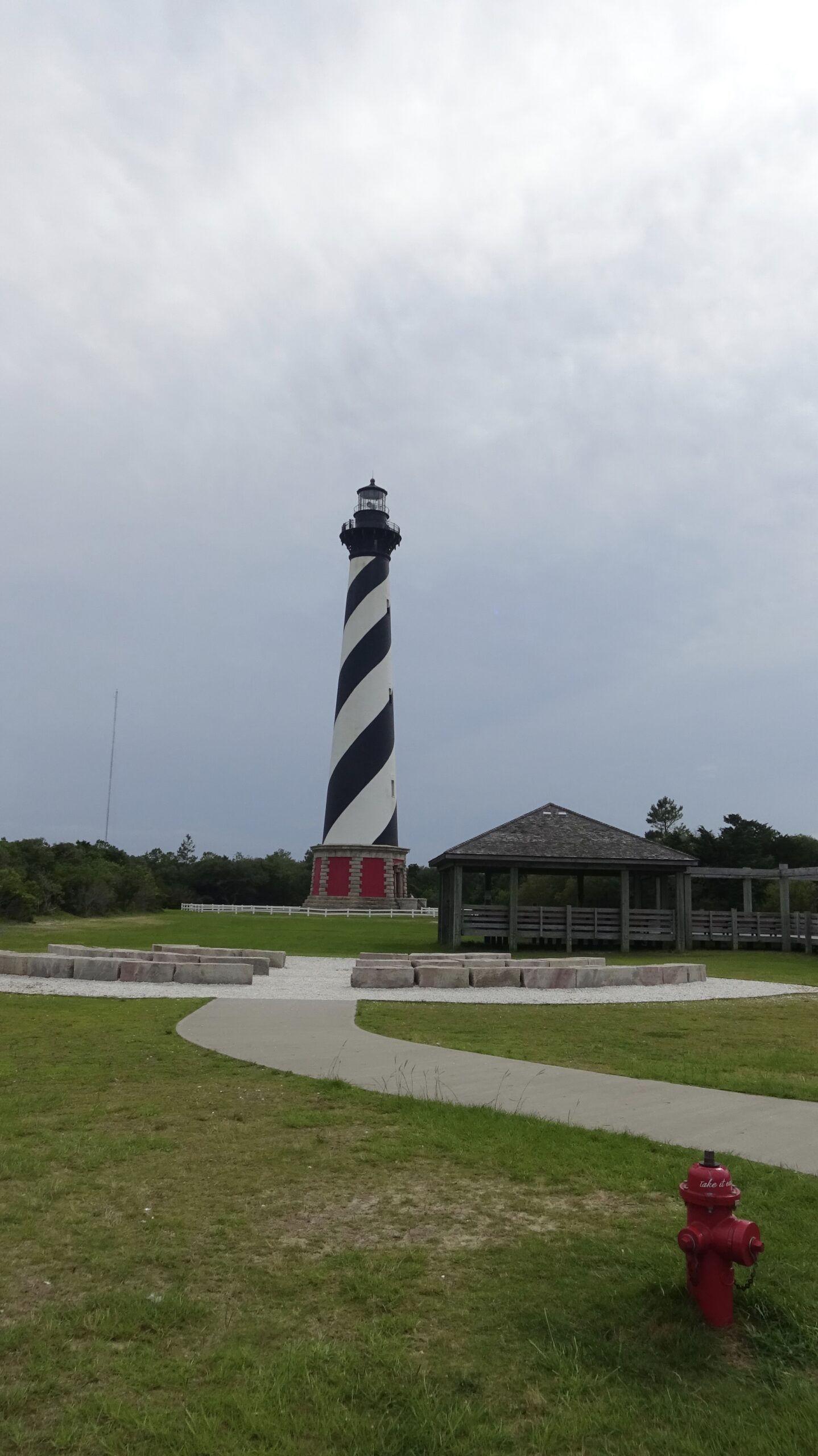
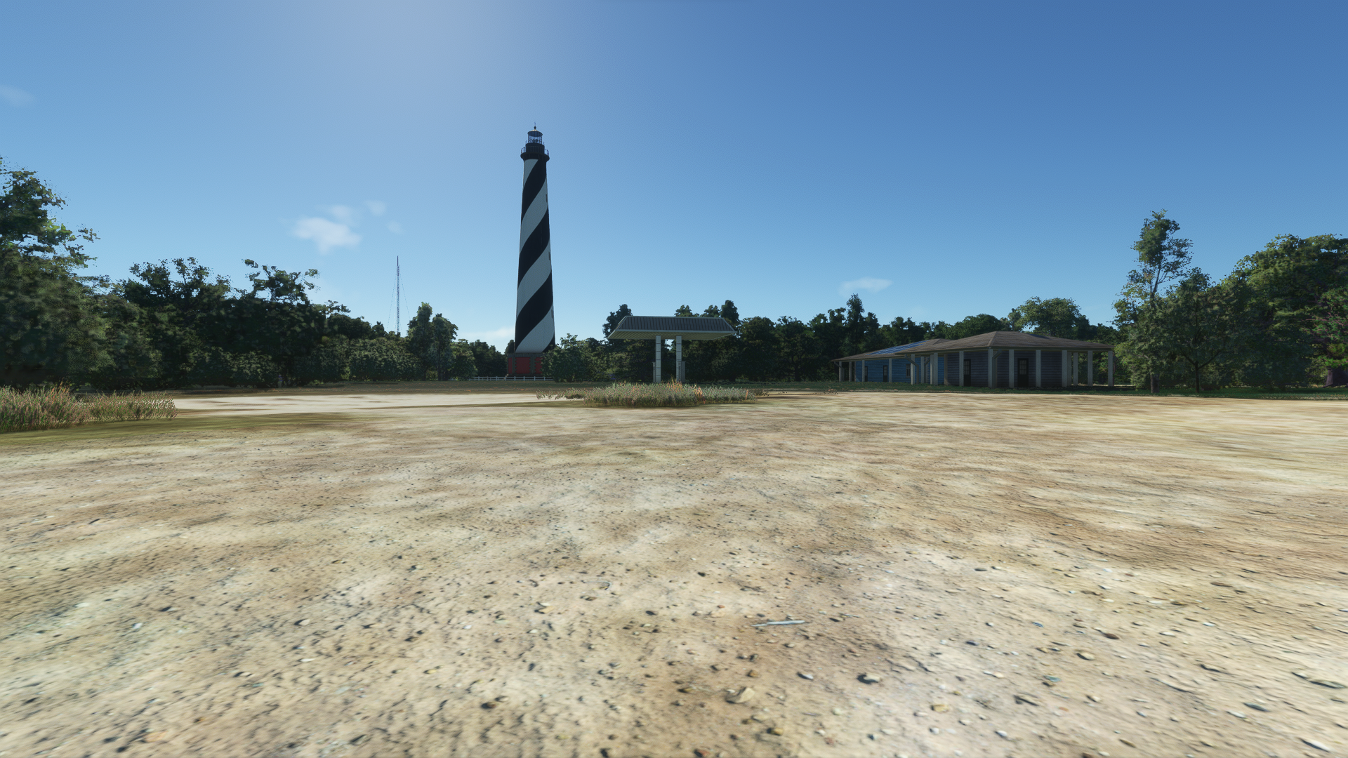
Upon reaching Cape Hatteras, you’ll see the shoreline make a sharp turn to the west. If you have installed World Update X, you should be able to spot Cape Hatteras Lighthouse near the cape. Built in 1870, the lighthouse is the tallest brick lighthouse in the United States and second tallest in the world behind Pointe de la Coubre in France. It is also the most famous of the lighthouses of the Outer Banks and as a result is the only one in the sim by default.
In 1999, coastal erosion placed the lighthouse just 15 feet from the waters edge putting it in imminent danger of collapse. Hatteras Lighthouse was famously picked up and relocated 2,900 feet from its original location. It now safely rests 1,500 feet from the shoreline.
Billy Mitchell Airport
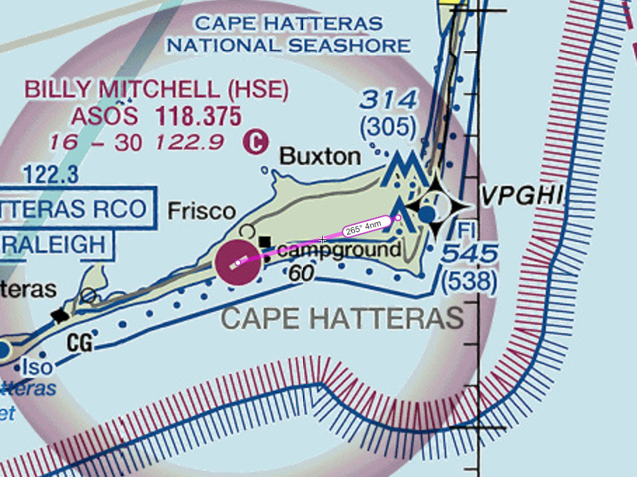
Turn right heading 265° and continue to follow the coastline for 4nm towards Billy Mitchell Airport (KHSE). The airport is named for William Lendrum Mitchell, regarded as the father of the United States Air Force. Mitchell was one of the earliest advocates for the development of military air power which put him at sharply at odds with Army and Navy leadership. To demonstrate the effectiveness of aircraft against ground and naval targets, Mitchell would undertake a series of arial bombardment demonstrations against captured German and decommissioned American naval vessels throughout the 1920s which included the sinking of the former USS New Jersey (BB-16) and USS Virginia (BB-13) off the coast of Cape Hatteras in 1923.
Ocracoke Island
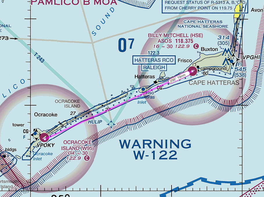
Once you pass KHSE, turn left heading 256° and follow the shoreline to the southwest for 19nm. You’ll soon cross Hatteras Inlet and enter Ocracoke Island. This sparsely inhabited island is only accessible by ferry or light aircraft. Ocracoke is perhaps most famous as the base of operations for Edward Teach, better known as Blackbeard the Pirate.
Blackbeard would meet his demise just off the shore the island on November 22, 1718 after a protracted battle with soldiers lead by Lieutenant Robert Maynard. During the clash, Blackbeard was reportedly stabbed twenty times and shot five times before finally succumbing to his injuries. His decapitated body was thrown into the inlet while his head was mounted to the front of Maynard’s ship as proof of his death. The head was reportedly mounted to a pole at the entrance to Chesapeake Bay as a warning to other pirates.
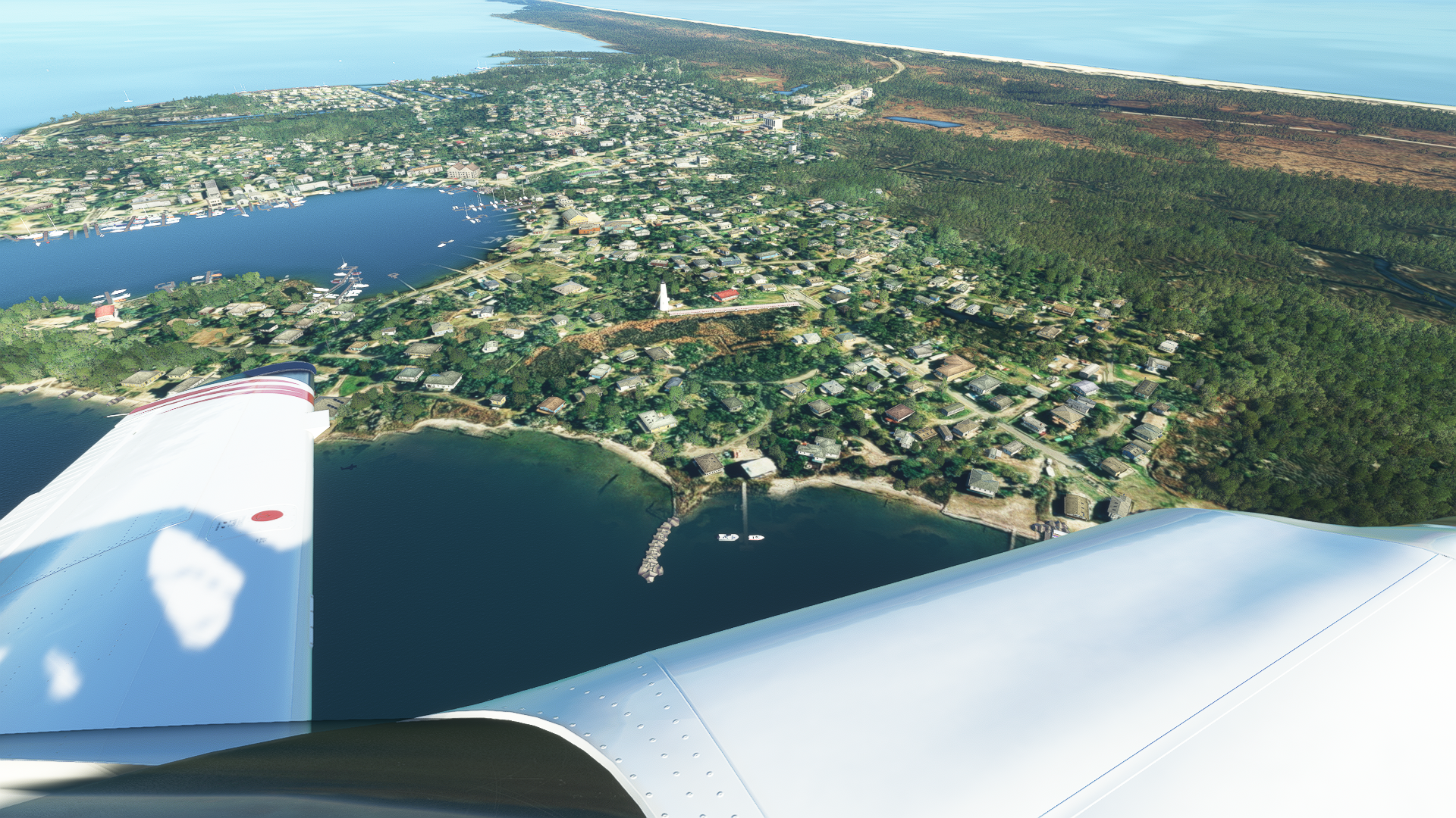
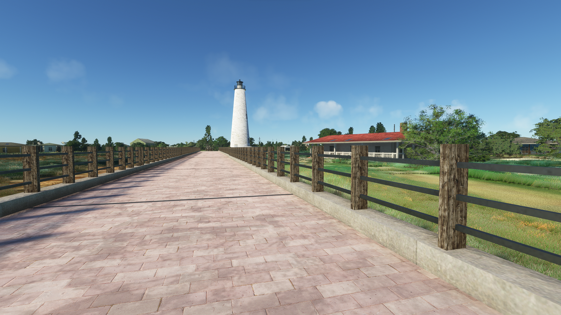
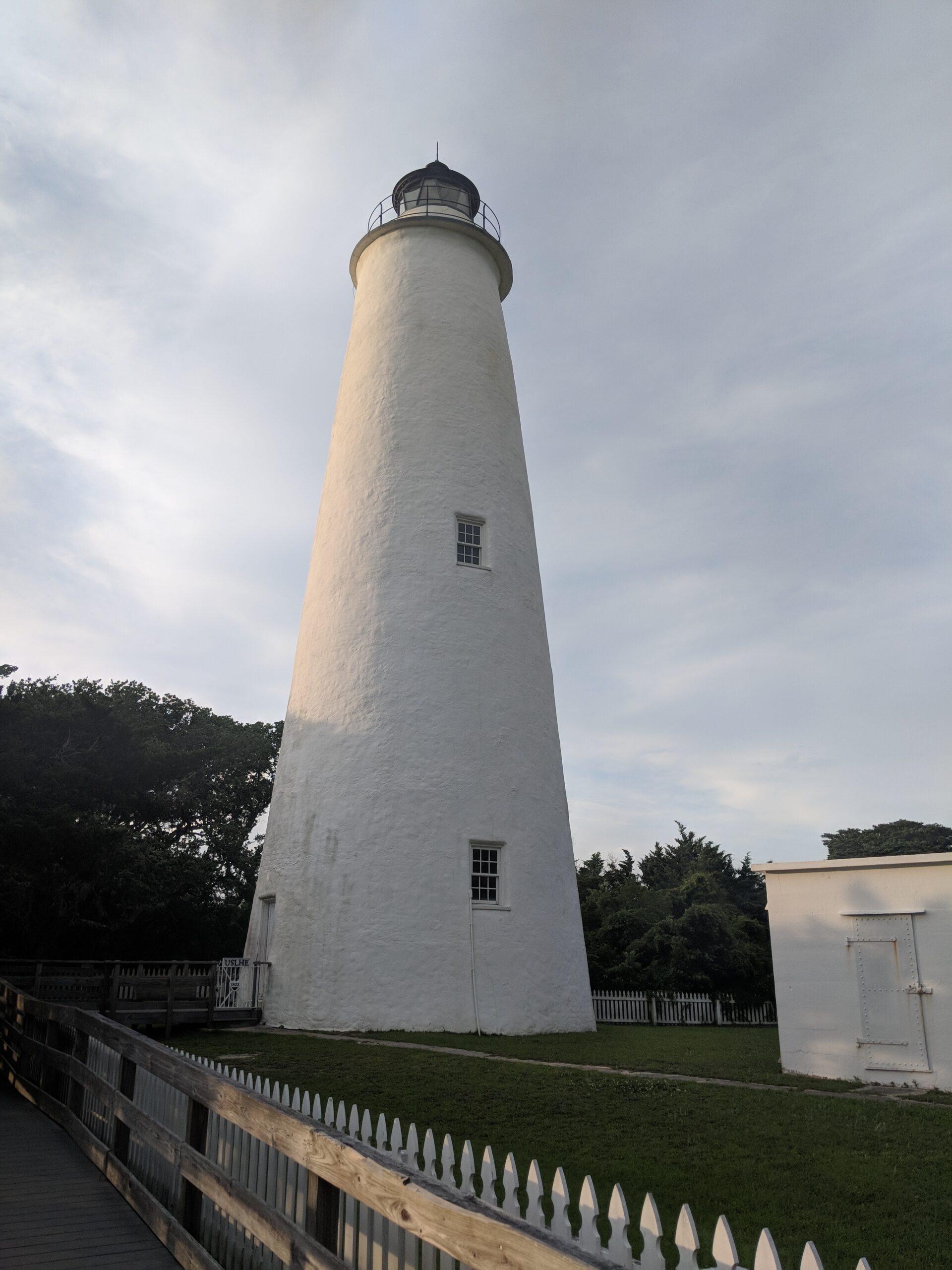
Ocracoke Airport (W95) should be just ahead next to the beach. If you would like, you can turn right and head towards the village of Ocracoke. If you installed Michaelvp’s Ocracoke Lighthouse, you should be able to spot it towards the center of town. The lighthouse was built in 1823 and stands at 75 feet tall, the shortest of the Outer Banks’ coastal lighthouses. It is the oldest operating lighthouse in North Carolina and second oldest that is still standing.
After rounding the tip of the island, we can line ourselves up for the approach to Ocracoke Airport (W95) or alternatively…
Bonus Trip – Cape Lookout

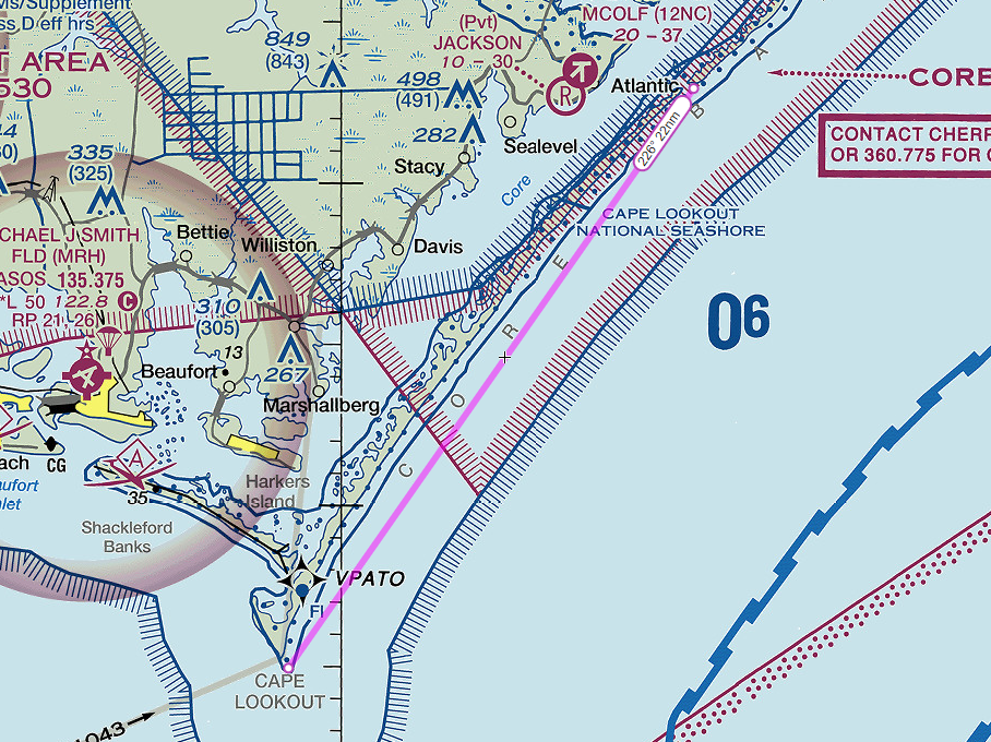
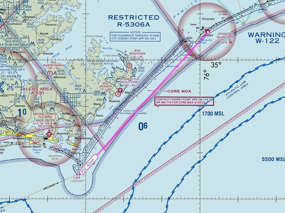
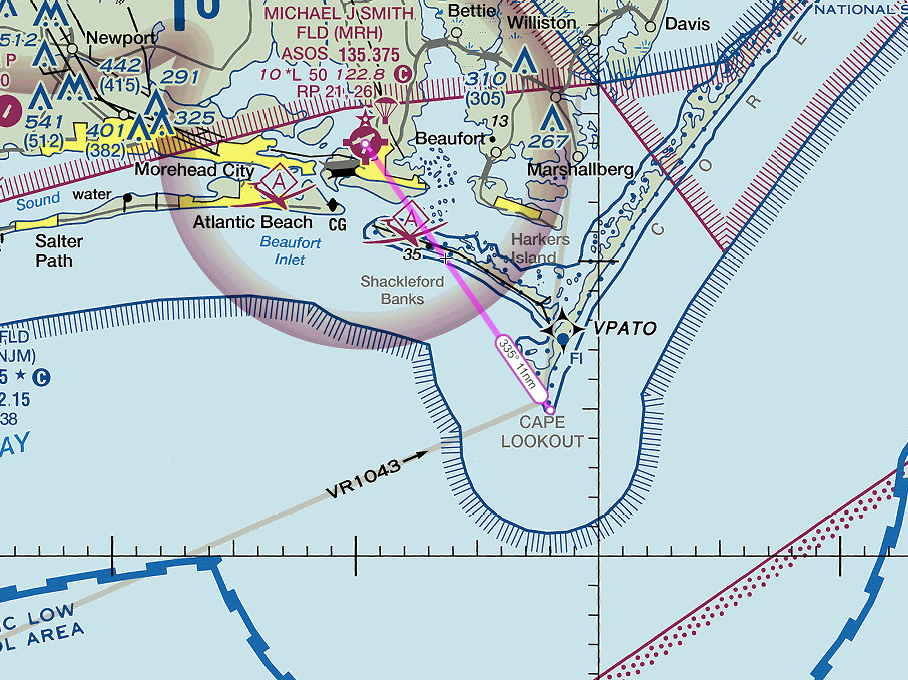
I had originally intended to end the flight at Ocracoke, but then I remembered Cape Lookout exists. If you have installed MazerMart’s Cape Lookout Lighthouse, turn right from W95 and follow heading 240°. Continue to follow the island chain to the southwest. After 20nm, turn right heading 226° and follow the island chain for another 22nm we will reach the uninhabited and remote islands of Cape Lookout National Seashore.
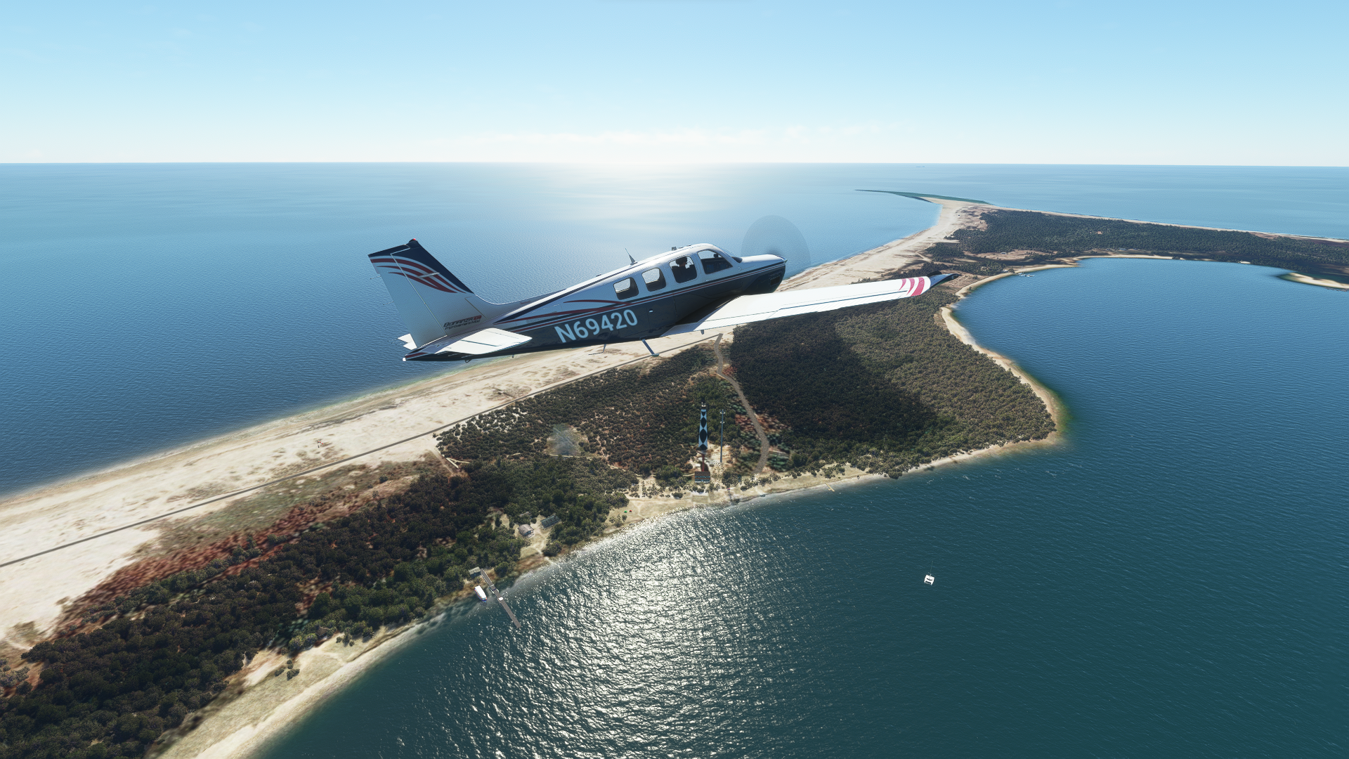
At the end of the cape we will encounter the distinctive Cape Lookout Lighthouse, that is if you downloaded the add-on. Completed in 1859 and standing at 163 ft tall, Cape Lookout is sometimes referred to as the “forgotten lighthouse” of the Outer Banks due to its remote location. It is only accessible by private boat or ferry and is the only Outer Banks Lighthouse I’ve never actually been to.
From here, you can either turn right heading 335° and head inland for 11nm towards Michael J Smith Field (KMRH) or, follow a heading of 052° for 42nm and return to Ocracoke as I had originally planned.
Arrival at Ocracoke Airport
If you choose not to continue to Cape Lookout or decided to turn around rather than head towards the mainland, we will now land at Ocracoke Airport (W95). The airport features minimal facilities on the ground, so plan on refueling elsewhere.
Now… one last note for the Super Hornet guy. If you actually flew this entire trip at full afterburner, you’re probably facing a fuel emergency at this point. You can try for Marine Corps Air Station Cherry Point (KNKT) 57 miles to the southwest. Depending on your altitude and remaining fuel, you might make it if you stop using the afterburner. Alternatively, you could just follow our VFR route, go full send into Ocracoke Airport, and deal with the consequences later.
In any case, I hope you’ve enjoyed this virtual tour of the Outer Banks of North Carolina. Be sure to join us next time on a Sim Pilots Guide, where we will take a tour of some other little corner of the world.
Flight Plans
- Dare County (KMQI) to Ocracoke (W95) – Guide as Written
- Dare County (KMQI) to Smith Field (KMRH) – Cape Lookout Bonus Trip
- Currituck County (KNOX) to Ocracoke (W95) – No Backtracking
- Currituck County (KNOX) to Smith Field (KMRH) – Cape Lookout, No Backtracking
- NAS Oceana (KNTU) to Ocracoke/Fuel Emergency (W95) – That Guy
Feel free to join our Discord server to share your feedback on the article, screenshots from your flights or just chat with the rest of the team and the community. Click here to join the server.