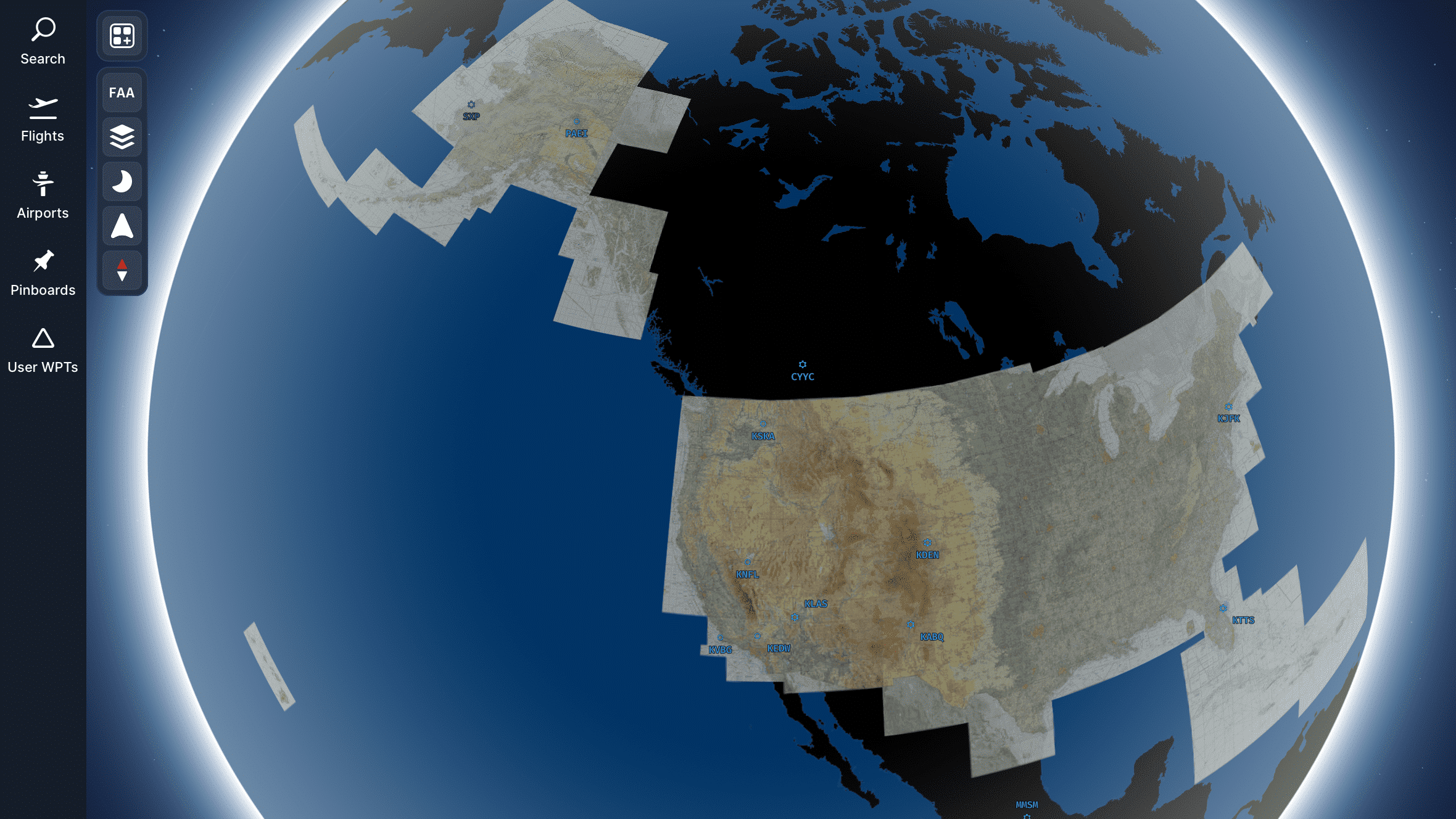
Navigraph, in a recent post on their forum, announced the addition of the FAA sectional charts on their Navigraph Charts application. This announcement is huge news for all the simmers who fly VFR in America.
What Are FAA Sectional Charts?
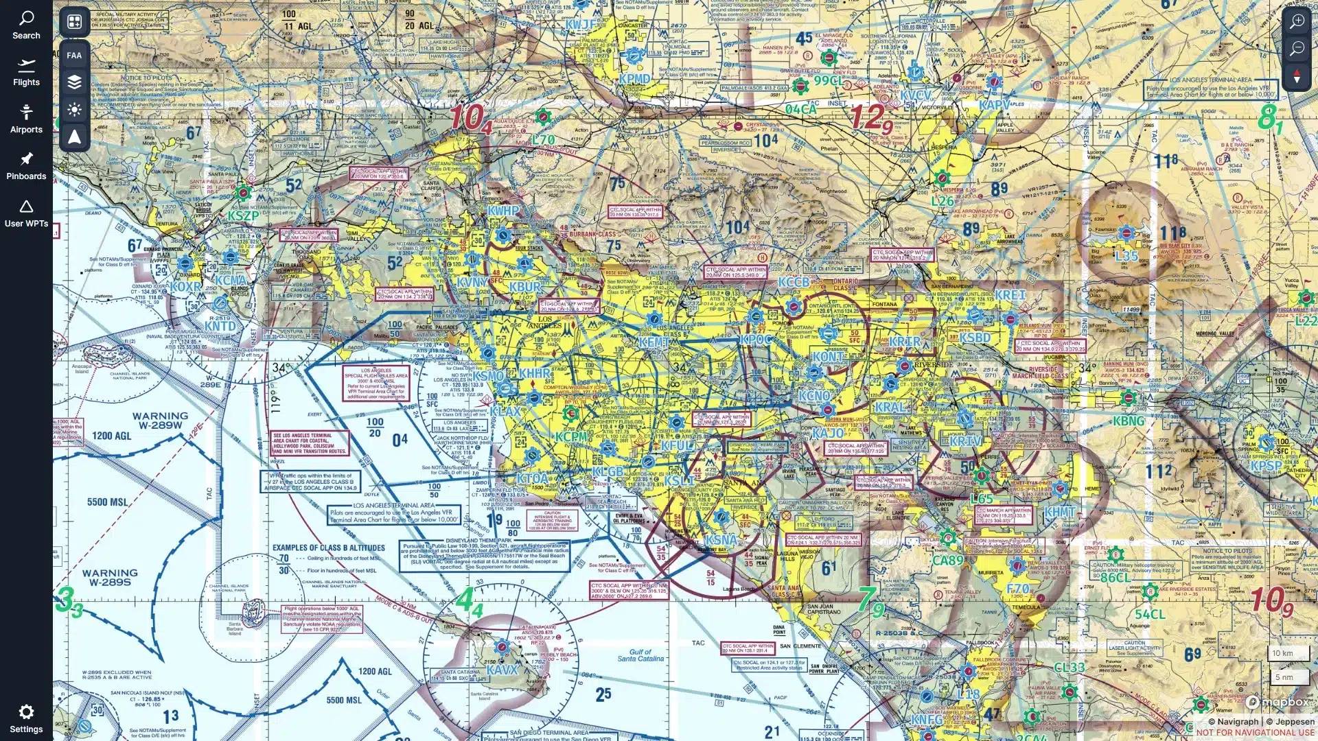
The Federal Aviation Administration (FAA) regulates civil aviation in America and is responsible for issuing the sectional charts. These charts are primarily produced for navigating slow to medium-speed aircraft that follow visual flight rules (VFR). These charts are of utmost importance and widely used due to America’s huge and diverse general aviation community.
The charts follow a scale of 1:500,000 and include a variety of information about the topography and checkpoints, including populated places, drainage patterns, roads, railroads, and other distinctive landmarks. The charts are updated every 56 days with visual and radio aids for navigation, airports, controlled airspace, restricted areas, obstructions, and related data.

Advantages of FAA Sectional Charts
These sectional charts provide an amazing level of detail and accuracy to pilots who are solely dependent on charts and visual cues for navigation. They help the pilots in some of the following ways:
- Local Information – It can be scary to fly to and land somewhere you have never been to before; these charts can prove to be very useful in these situations by providing you with information about all the radio frequencies, airstrips and other landmarks. They ensure that you have a good idea about the area before you fly there.
- Airspace Clarity – At times, it can be a hurdle to navigate through busy airspaces with active NOTAMs and complex boundaries. Sectional charts come in to help and provide a clear picture of where you can fly with no restrictions and where one has to follow specific procedures.
- Fuel Stops – These charts can come in very handy when looking for a place to land and refuel; they highlight every single fuel stop in the vicinity, ensuring you never have to worry about running out of gas mid-flight.

Terminal Area Charts
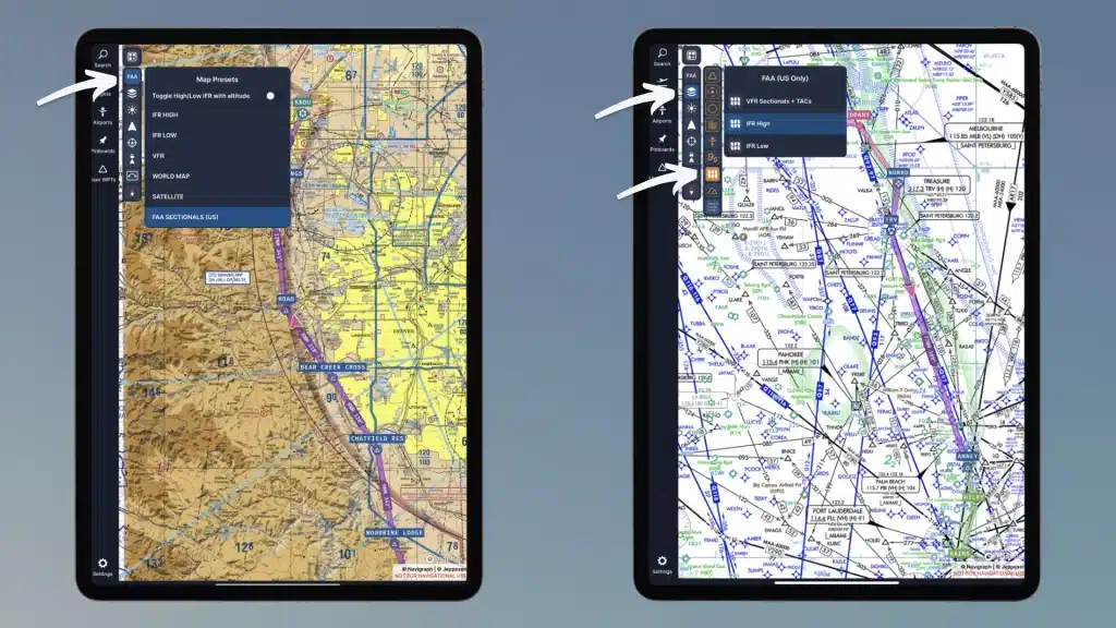
Navigraph has also added Terminal Area Charts (TACs) along with the sectional charts. These charts are for the pilots who fly into busy airspace with heavy control requirements. These charts provide greater detail for Class B and C airspace than sectional charts, owing to their scale of 1:250,000.
These charts are also updated every 56 days and are indicated by white-shaded boxes on the Sectional Chart index. To access them on the Naviraph charts app, simply zoom into the maps’ white edges, and the Charts app will seamlessly transition to the TACs.
How To Access The Sectional Charts
The FAA Sectional charts have been made available across all platforms supported by the Navigraph charts application, including the In-Game Panel for Microsoft Flight Simulator 2020. The feature can be enabled by selecting the “FAA SECTIONALS (US)” option from the right-hand panel. IFR High and Low charts can now also be selected through the same section.
A Navigraph Ultimate subscription, available for €9.05 monthly or €81.64 yearly, is necessary to access these charts.
Feel free to join our Discord server to share your feedback on the article, screenshots from your flights or just chat with the rest of the team and the community. Click here to join the server.